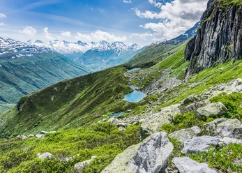
The Rotondo Hut, located at 2,570 meters above sea level, offers beautiful hikes in the summer and fantastic ski tours in the winter. The sun terrace provides a sensational view of the Witenwasser Glacier, which is made even more enjoyable by the hut’s culinary specialties.
The route begins in Realp (1,538 m above sea level). The trail leads into the Witenwasser Valley along the wide and very well-maintained military road toward Oberstafel. Passing green meadows and surrounded by impressive mountain ranges, you hike up the winding road. The road requires a permit, so vehicle traffic is limited, making the hike even more enjoyable.
At point 2155, on the right as you walk, the hike leaves the military road and follows a well-trodden path around the Helig Egg up to the Rotondo Hut at 2,570 m above sea level.
- 6:16 h
- 18.17 km
- 1,036 m
- 1,036 m
- 1,537 m
- 2,570 m
- 1,033 m
- Start: Realp Train Station
- Destination: Realp Train Station
Pavements
- Asphalt (67%)Path (33%)
Best to visit
- suitableDepends on weather
Directions
- Realp – Oberstafel – Helig Egg – Rotondo Hut
Tour information
Nature highlight
Refreshment stop
Tour with dog
Equipment
- Clothing appropriate for the weather
- Sturdy footwear
- Hiking poles are recommended
Directions & Parking facilities
- Getting there
Realp is easily accessible by car: From the north, take the A2 to Göschenen, and from there drive 6 kilometers through the impressive Schöllenen Gorge and across the world-famous Devil’s Bridge to Andermatt. Continue toward the Furka Pass until you reach Realp.
From the south, you can reach Göschenen in the summer via the Gotthard Pass or year-round through the Gotthard Tunnel, and from there continue into the Urseren Valley and on to Realp.
From the west, coming from Valais, you can reach Realp via the Furka Pass or by car ferry from Oberwald to Realp.
From the east, in the canton of Graubünden, you can reach Andermatt via the Oberalp Pass or by car ferry from Sedrun, and from there follow the Furkareuss River to Realp.
If you do not plan to hike the entire route, you can drive into the Witenwasserental Valley as far as Oberstafel with a driving permit. The driving permit can be obtained from the Ursern Corporation, Andermatt-Urserntal Tourismus GmbH, or via Parkingpay.
ParkingDaily parking spaces are marked outside the village (MGB / Grotto Stella d'Oro area) and in the village square; they are available for a fee between 6:00 a.m. and midnight. For more information: Realp Municipal Office
Public transportationThe starting point, Realp, can be reached by train on the Matterhorn Gotthard Railway from Andermatt or Oberwald. The schedule is as follows: SBB Schedule
Additional information
- For information about the hut, visit: Rotondo Hut SAC
If you have any further questions, please feel free to contact: Andermatt Vacation Region, +41 41 888 71 00, [email protected]
Author
Andermatt-Urserntal Tourismus GmbH
Organization
Région de vacances Andermatt
Author´s Tip / Recommendation of the author
- Watching Ibex
- Vehicle Permit for Witenwasserntal (available from the Ursern Corporation)
- Other routes and winter access points: Rotondo Hut
Safety guidelines
- Hikers should check the weather forecast in advance, as parts of the hike are at an elevation of over 2,000 meters above sea level, and light snowfall is possible in extreme cases.
Pay attention to the weather forecasts. Weather conditions in the Alps can change rapidly.