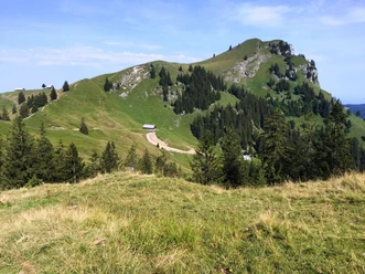
Sattelegg - Chli Aubrig

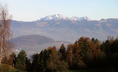
We have reached the highest point of Chli Aubrig with summit logbook and magnificent view and look around enthusiastically. Although Chli Aubrig is by far not the highest mountain here, it lies quite alone in the landscape next to its big brother, Gross Aubrig, with which it is often climbed together. Glarus Alps, Wägital peaks, Mythen peaks and the Sihlsee with Einsiedeln present themselves from up here in the best light. The rock face drops steeply to the north – one step too many would indeed be one too many here.
The mountain is apparently quite crowded on nice weekends, as Schlieren local Heinz Karrer explains to us. Not THE Karrer, he adds, and it is good that we are here on a weekday. He also has his own website with route tips; you just have to add a .ch to his name. Heinz knows every path here and also the pathless routes over the jagged ridges. His explanations inspire a desire for more – such as “his” crossing from Lauiberg to Twäriberg via Miserenstock and Höch Hund, all along the sharp ridge, eight to nine hours including a bit of climbing, but not difficult. And have I already been to the wonderful Sihlseeli? We get quite dizzy from all the heights and names. Well, next time.
- 3:20 h
- 9.48 km
- 462 m
- 462 m
- 1,180 m
- 1,641 m
- 461 m
- Start: Sattelegg
- Destination: Sattelegg
Good to know
Pavements
Best to visit
Directions
Tour information
Loop Road
Summit
Equipment
Directions & Parking facilities
Additional information
Author
Schwyzer Wanderwege
Organization
Schwyzer Wanderwege
Nearby

Download GPX file