Schächentaler high route in the Klausen Pass area


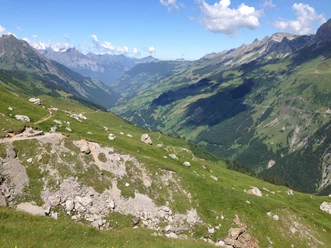
The Schächentaler historically has great importance as a connecting road between Uri and Glarus. Today it is one of the most popular high routes in the Alps. Already at the start, our views wander up to the huge massif dominated by famous mountains: Clariden, Scherhorn, Ruchen, Grosse Windgällen, and Kleine Windgällen.
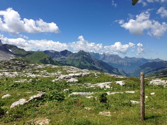
For the plant world, the south slope of the Schächental is richly equipped with different biotopes. Here we will find some of the most valuable dry meadows and fens in Switzerland. These biotopes are habitats for rare, protected animal and plant species, which we encounter on many sections along the high route.
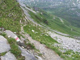
At the beginning, we walk through lush alpine meadows to Untere Balm. After a short section on the Klausen Pass road, the path leads over a natural road to Alp Heidmanegg. After Heidmanegg, the trail leads us on narrow mountain paths through varied, light forests and through open flower-rich alpine meadows. Above Ratzi, the narrow mountain path merges into a natural road that leads us to Biel. Afterwards, we cross the valley basin of Selez and reach Flesch Seeli. This spot is an ideal family rest area with a fireplace. If you want, you can also eat and drink at the nearby kiosk. After Grüner Boden, which leads through a light forest section, you reach the mountain station Eggbergen. The view of Lake Uri and the largest wild hay area of the canton of Uri below the Rophainen rounds off this impressive experience.
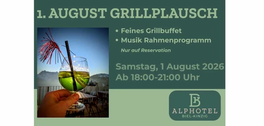
Book your accommodation in the Uri holiday region here: booking.uri.info!
You can find experiences in the Uri holiday region here: uri.info!
- 6:40 h
- 20.76 km
- 465 m
- 883 m
- 1,439 m
- 1,869 m
- 430 m
- Start: Hotel Klausenpasshöhe
- Destination: Eggberge
Good to know
Pavements
Best to visit
Directions
Hotel Klausenpasshöhe - Untere Balm - Obere Balm - Chäseren - Heidmannegg - Alt Stafel - Mettenen - Gruebenhütten - Hegerswald - Äbnet - Äbneter Wald - Sidenplangg - Obere Gisleralp - Wissenboden - Biel - Wiltschi - Mättental - Alafund - Rueggig - Selez - Flesch Seeli - Angelingen - Eggberge
Tour information
Nature Highlight
Stop at an Inn
Equipment
Good shoes (it can be wet here and there in spring), sun protection, rain protection, day backpack
Recommended map material:
Directions & Parking facilities
Additional information
Author
Markus Fehlmann
Organization
Verein Urner Wanderwege
Author´s Tip / Recommendation of the author
Take your time and divide the hike into two halves. You can stay comfortably and inexpensively both at Ratzi and Biel.
Map

Nearby