Stans - Kalcherli - Stanserhorn

- 4:50 h
- 11.04 km
- 1,504 m
- 89 m
- 450 m
- 1,843 m
- 1,393 m
- Start: Stans
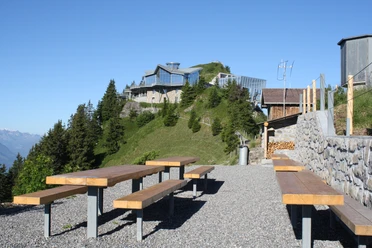
- Destination: Stanserhorn
Waypoints
Start
Destination
Good to know
Pavements
Street (1%)
Asphalt (18%)
Trail (9%)
Path (72%)
Best to visit
suitable
Depends on weather
Equipment
Good shoes, a rain jacket and enough drinking water for the journey are part of every hike.
Directions & Parking facilities
Getting there
Take the A2 highway to the Stans-Nord exit. Follow the signs to the Turmatt municipal parking lot or the train station parking lot. The valley station of the Stanserhorn cable car is located in the town center at Stansstaderstrasse 19. From Lucerne you can reach Stans in approx. 15 minutes. The valley station is a 5-minute walk from the parking lots.
Parking
Parking is limited and all parking spaces are subject to a charge.
Public transportation
From Lucerne railroad station, you can reach Stans comfortably and relaxed in 13 minutes with the Zentralbahn (Lucerne - Stans - Engelberg line).
Author
Marco Burgener
Organization
Lucerne Tourisme

Nearby