Sternenegg bike route


From Oberiberg, you ride entirely on the main road to Chaltenbrunnen, where you turn off onto the side road to Sternenegg. From there, it goes steadily uphill through light forest to Sternenegg.
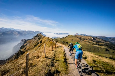
The view from Sternenegg of Lake Lucerne and the surrounding mountains is breathtaking and rewards you for the effort of the ascent.
At Sternenegg, continue straight ahead (following the hiking trail signs towards «Ober Altberg» and «Ibergeregg» 967») until you reach a fork about 650m later. There turn left, following the «Hoch-Ybrig Bike 967» signs. Another 450m later after a descent, you arrive at the Alp «Ober Altberg».
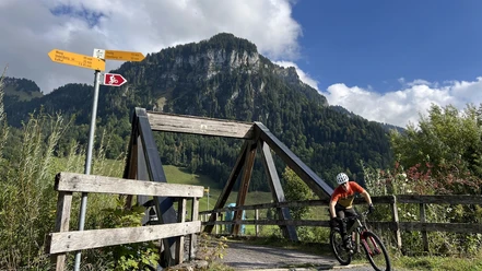
Now, following the signs towards «Ibergeregg» or «Hoch-Ybrig Bike 967», turn right onto a technical single trail that leads you to the Ibergeregg pass road.
At the pass height, after the Hotel Passhöhe, turn left off the road over the parking lot to the hiking signs north of Ibergeregg towards Hobacher.
On the well-developed so-called "old Schwyzerweg" you ride back via Hobacher, Aenglisfang, Laucheren valley station and back to the starting point Neuseewen Oberiberg.
- 1:50 h
- 14.00 km
- 515 m
- 515 m
- 1,068 m
- 1,517 m
- 449 m
- Start: Oberiberg, Neuseewen
- Destination: Oberiberg, Neuseewen
Good to know
Pavements
Best to visit
Directions
Tour information
Loop Road
Stop at an Inn
Equipment
Directions & Parking facilities
Take the A3 motorway to the exit Richterswil/Schindellegi, then continue towards Samstagern, Biberbrugg, Einsiedeln. Afterwards follow the signs for Ybrig to Oberiberg. Free parking in the village center
Author
Region Ybrig
Organization
Region Ybrig
Safety guidelines

Nearby

Download GPX file