Surenen Pass


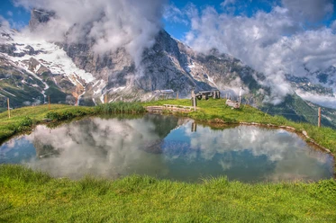
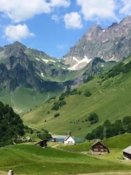
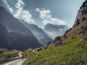
The Surenen Pass is one of those hikes that lingers in your memory. The start alone promises greatness: from Engelberg, the path leads into the wild Suren Valley, past alpine pastures, rushing mountain streams, and impressive waterfalls. Step by step, the landscape becomes more alpine, the mountains draw nearer, and the historic pass crossing opens a scene considered one of the most impressive in Central Switzerland. The Surenen Pass is part of the Via Alpina and connects Engelberg with the Uri Reuss Valley via one of the region's most beautiful crossings.
Around Blackenalp, Stäuber and the pass, the mountain scenery shows itself particularly impressively: on one side, the view towards Titlis, on the other over the Uri Alps, Lake Uri, and the Reuss Valley. It is precisely these contrasts that make the tour so special — sometimes wild and rocky, sometimes wide and gentle, but always full of landscape and character.
Those who want to soften the long pass hike a bit can ideally combine it with the small cable cars Fürenalp and Brüstli. Thus, the big Via Alpina stage becomes a manageable yet impressive day hike. Using the two cable cars, the walk takes about 6 hours. A combined ticket is available for both cable cars.
These two cable cars you can use for this:
- Engelberg-Fürenalp cable cars
- Attinghausen-Brüstli
- 8:00 h
- 24.11 km
- 704 m
- 2,124 m
- 434 m
- 2,292 m
- 1,858 m
- Start: Engelberg
- Destination: Attinghausen
Waypoints
Good to know
Best to visit
- suitableDepends on weather
Directions
- From the mountain station Fürenalp, follow the signposted mountain hiking trail towards Surenen Pass. Over alpine terrain and past Blackenalp, the route leads to Unter Schatzboden and from there steadily uphill to Surenen Pass. After the pass height with views of Titlis, Schächen Valley Alps, Lake Uri, and Reuss Valley, descend over Langschnee, Angistock, Geissrüggen, and Alp Grat to Brüstli. From the Brüstli mountain station, take the cable car down to Attinghausen.
Directions & Parking facilities
- Getting there
By car, take the A2 (Basel-Gotthard) to Stans Süd, then follow the main road for 20 km to Engelberg. Engelberg is 30 minutes from Lucerne, 1 hour and 15 minutes from Basel, Zurich, or Bern.
ParkingParking is available in Engelberg for a fee.
Public transportationNational and international connections (from Zurich Airport, connections every half hour with approx. 1h travel time) to Lucerne. Afterwards, take the Zentralbahn in 43 minutes through varied landscapes and gorges up to Engelberg. Additional information
- Via Alpina
The Surenen Pass hike is part of the Via Alpina. The Via Alpina runs through 8 countries and extends over 5000 km in more than 300 day stages. There is a hiking pass for the Via Alpina. This stage can be stamped at the tourism office of Engelberg Titlis Tourism.
Detailed description of the route on Schweiz Mobil
Author
Engelberg - Titlis Tourismus
Organization
Engelberg-Titlis Tourismus
Author´s Tip / Recommendation of the author
- Various mountain huts in the alpine summer
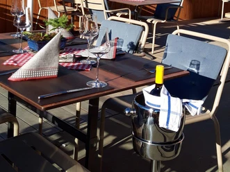
Along the route, several mountain huts invite you to stop during the alpine summer. The path also passes by the Surenen cheese dairy. During the alpine season, the herders gladly offer their fresh alpine products and invite you to enjoy a cool drink or a small snack in their alpine huts. Safety guidelines
- The Surenen Pass is generally accessible from June to mid/end October – depending on snow conditions. Please check with the Engelberg - Fürenalp or Attinghausen - Brüstli cable car for current conditions.