Fürenalp-Dagenstall-Wasserfall


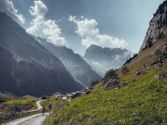
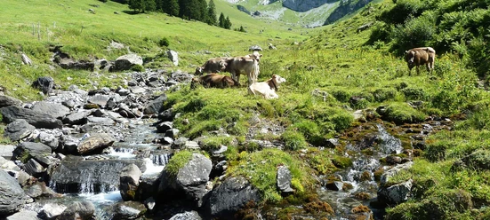
The hike leads over meadows with unique alpine flowers and past numerous alpine buildings. The Engelberg monastery extracted bricks for their buildings from the shale quarry. Can you see the extraction marks? The nearby hydroelectric power plant produces electricity for the Engelberg monastery. In the past, the monks operated the plant themselves and cleaned the small lake together every summer. Stop at the start/finish of the hike at Engelberg's highest waterfall. With a drop of 60 m, the Tätschbachfall, better known as the "Waterfall," is an impressive natural spectacle and a wonderful place to recharge. Can you hear the different tones of its roaring? At the foot of the fall is the Restaurant Wasserfall.
- 1:30 h
- 4.12 km
- 27 m
- 800 m
- 1,068 m
- 1,842 m
- 774 m
Waypoints
Good to know
Pavements
Best to visit
Directions & Parking facilities
Additional information
Author
Engelberg - Titlis Tourismus
Organization
Engelberg-Titlis Tourismus
Author´s Tip / Recommendation of the author
Power spots Quellenweg Engelberg - Dagenstal - Fürenalp
Dr. Andrea Fischbacher has identified and documented the 17 power spots along the Engelberg - Dagenstal - Fürenalp hike. Recharge your energy.

Nearby


