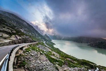
Susten Pass: Wassen - Innertkirchen


The Susten Pass (2224 m above sea level) connects the Urner Reuss Valley with the Hasli Valley in the Bernese Oberland. The technically spectacular Susten Pass road was only opened in 1945 and is the first pass road in the Alpine region specially designed for motor vehicle traffic.
Through the largely untouched and picturesque Meiental, you finally reach the pass summit, which is crossed by a summit tunnel. On the Bernese side of the tunnel, a large parking lot and a few meters above the pass road, the Susten Hospice provide a rest stop. During the descent, motorists repeatedly enjoy overwhelming views of the Gadmental and the Steingletscher. The road leads down in partly tight curves to the village of Gadmen with its beautiful old houses.
- 0:40 h
- 45.85 km
- 1,319 m
- 1,601 m
- 626 m
- 2,224 m
- 1,598 m
- Start: Wassen
- Destination: Innertkirchen Station
Good to know
Pavements
- Street (100%)
Best to visit
- suitableDepends on weather
Directions
- Wassen - Susten Pass - Innertkirchen
Tour information
Nature highlight
Refreshment stop
Directions & Parking facilities
- Getting there
Wassen is directly accessible by the A2 motorway via a motorway exit. The Gotthard motorway is the connecting road between Ticino and Central Switzerland.
ParkingIn Wassen, there are some parking spaces directly by the old station. In addition, there are also some parking options in the village.
Public transportationTake the train to Göschenen or Erstfeld and then take the bus to Wassen and further towards Susten Pass. The timetable is as follows: SBB Timetable
Additional information
Author
Andermatt-Urserntal Tourismus GmbH
Organization
Région de vacances Andermatt
Author´s Tip / Recommendation of the author
- Ride with the Triftbahn. About a 2-hour hike with views of the glacier and the glacier lake. The highlight is crossing the Trift Bridge.
Safety guidelines
- The Susten Pass is closed in winter.