"The Easy": Hunds-Chopf

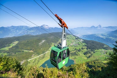
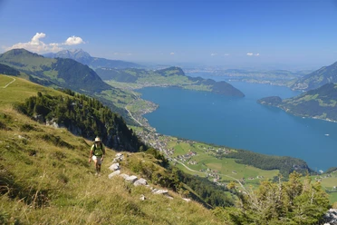
The easy route starts with a ride on the aerial cableway to Niederbauen. From there, take the flat path over the Hofad through the Ebnet to the stones. Then keep left by crossing the south-facing AlpChulmhalde in the lower part. Now only a few steps remain onto the rock ridge. Ahead of us lies the inexhaustible view of Lake Uri and the eastern Uri mountains. There is an opportunity to sit down, rest, and relax. However, Hunds-Chopf should not be used as a playground, as the slopes fall steeply. For the return journey, we recommend taking the same path.
- 2:00 h
- 3.94 km
- 107 m
- 106 m
- 1,570 m
- 1,663 m
- 93 m
- Start: Niederbauen mountain station
- Destination: Niederbauen mountain station
Good to know
Pavements
Best to visit
Directions
From the Niederbauen mountain station, go to Hunds-Chopf and then back again.
Directions & Parking facilities
Parking spaces are available at the Niederbauen aerial cableway valley station.
By car or post bus (stop Emmetten, Post) to the Niederbauen aerial cableway valley station.
Additional information
For tourist information:
Nidwalden Tourism
Bahnhofplatz 2
6370 Stans
+41 (0)41 610 88 33
More routes at nidwalden.com/wandern
Author
Nidwalden Tourismus
Organization
Nidwalden Tourismus
Safety guidelines
The path is very easy to walk, with light hiking equipment or good casual footwear.

Nearby