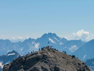
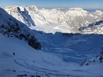
Titlis round route - the alpine classic

The route requires mountaineering skills. A safe avalanche situation, solid climbing technique and handling of abseiling are mandatory. A mountain guide is recommended!
- 7:00 h
- 9.20 km
- 417 m
- 2,530 m
- 1,082 m
- 3,035 m
- 1,953 m
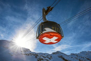
- Start: Klein Titlis, mountain station
- Destination: Engelberg
Good to know
Best to visit
suitable
Depends on weather
Directions
Behind Titlisjoch - Ober Stäfeli (Engelberg - OW) - Firnalpeli - Chell (Engelberg - OW)
Equipment
Equipment can be rented in the sports shops in Engelberg.
Directions & Parking facilities
Getting there
By car, take the A2 (Basel-Gotthard) to Stans Süd, then 20 km on the main road to Engelberg. Engelberg is 30 minutes from Lucerne, 1 hour and 15 minutes from Basel, Zurich or Bern.
Parking
Parking is available in Engelberg for a fee.
Public transportation
National and international connections (from Zurich Airport half-hourly connections with about 1 hour travel time) to Lucerne. Then with the Zentralbahn in 43 minutes through varied landscapes and gorges up to Engelberg.
Additional information
Author
Engelberg - Titlis Tourismus
Organization
Engelberg-Titlis Tourismus
Author´s Tip / Recommendation of the author
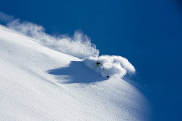
Safe snow fun in the powder snow at the Snow & Safety Days.
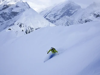
Safety guidelines
Safety tips for ski routes in open terrain
- Please note that you are traveling at your own risk
- A ski route must be carefully planned.
- Appropriate equipment (avalanche transceiver, probe, shovel, airbag) and clothing are essential safety factors
- The local ski and mountain guides will safely bring you to your destination and back home
- Emergency number REGA telephone 1414
Nearby