Via Urschweiz, 1st stage


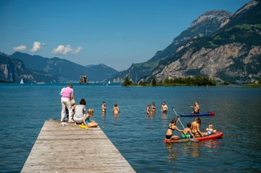
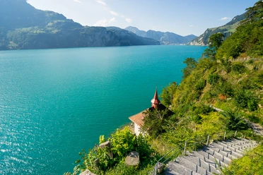
Directly at the train station as well as at the bus and boat station Flüelen, we start along the "Way of Switzerland" heading south to the Schützenhaus. Here the path branches off and crosses the Reuss River and continues through the wonderfully beautiful nature reserve Reuss delta, past the artificially created islands to Seedorf. Along the shores of Lake Uri heading north, we quickly reach the Isleten peninsula via the Bolzbach. Here we can refresh ourselves or enjoy a swim in Lake Uri.
From now on we climb over steep rock ledges into the romantically wild mountain village of Isenthal, which has retained much of its original character to this day. The valley has only been accessible by road since 1951.
- 3:04 h
- 10.51 km
- 345 m
- 1 m
- 434 m
- 775 m
- 341 m
- Start: Flüelen train station
- Destination: Post bus stop Isenthal village
Good to know
Pavements
- Street (30%)Trail (54%)Path (16%)
Best to visit
- suitableDepends on weather
Directions
- Flüelen train station - Schützenmatte - Allmeini - Reusssteg - Schanz - Schwäb - Seerestaurant Seedorf - Seemätteli - Bolzbach - Schiltegg - Isleten - Chäppeli - Birchi - Ringli - Isenthal village
Tour information
Culturally interesting
Nature highlight
Refreshment stop
Equipment
- Hiking boots and day backpack
Directions & Parking facilities
- Getting thereYou can reach Flüelen via the Axen road or via the highway from Lucerne. Flüelen has its own exit.ParkingThere are enough paid parking spaces at Flüelen train station.Public transportationYou can easily reach Flüelen by train. From Isenthal village you can take the post bus back to the starting point.
Additional information
Author
Markus Fehlmann
Organization
Verein Urner Wanderwege
Author´s Tip / Recommendation of the author
- You can take the boat from Flüelen to Isleten or then take the post bus from Isleten to Isenthal.
Safety guidelines
- None