ViaJacobi stage 5: Einsiedeln – Schwyz


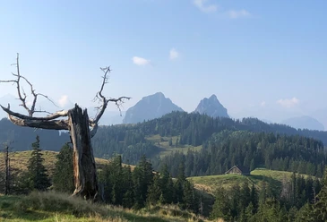
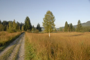
The hike begins from Einsiedeln towards Alpthal passing the Au Monastery. After a leisurely flat start, you go right in Alpthal up the hiking trail to the mountain inn Haggenegg. After a tasty break with a great view, you descend from Haggenegg into the Schwyz valley basin.
- 5:23 h
- 17.67 km
- 533 m
- 890 m
- 524 m
- 1,414 m
- 890 m
- Start: Einsiedeln station
- Destination: Schwyz
Good to know
Pavements
Street (22%)
Asphalt (28%)
Trail (49%)
Best to visit
suitable
Depends on weather
Directions
Einsiedeln station - Trachslau - Alpthal - Haggenegg - Schwyz
Tour information
Cultural Interesting
Stop at an Inn
Equipment
- Good footwear
- Water bottle
- Hiking map
- Mobile phone
Directions & Parking facilities
Getting there
To Einsiedeln / SZ:
- Take exit no. 39 (Schindellegi) on the A3 motorway from Zurich. Then via Schindellegi - Biberbrugg to Einsiedeln.
- Take exit no. 37 (Richterswil) on the A3 motorway from Chur. Then via Schindellegi - Biberbrugg to Einsiedeln.
- From Lucerne, Zug, Schwyz, Gotthard to Schwyz and canton road no. 8 via Sattel - Rothenthurm - Biberbrugg to Einsiedeln.
Parking
Parking garage Brüel in Einsiedeln (paid)
Public transportation
By train to Einsiedeln station:
- From Zurich via Wädenswil to Einsiedeln station.
- From Lucerne via Goldau - Biberbrugg to Einsiedeln station.
Additional information
Author
Einsiedeln-Ybrig-Zürichsee Tourismus
Organization
Schwyzer Wanderwege
Author´s Tip / Recommendation of the author
Take a guided tour of Einsiedeln Monastery. More info can be found here.
Nearby


