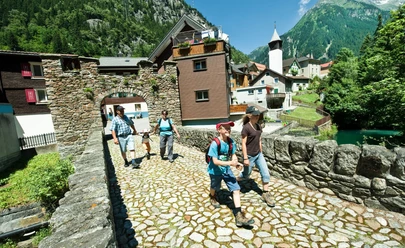
Water route


Discover the fascinating natural world of the Göscheneralp on the family-friendly themed route along the Göschenerreuss. Between Göschenen and the dam, 15 exciting stations convey interesting facts about water, glaciers, geology, and biodiversity. For little explorers, five rest areas invite playful exploration of nature.
How it works
The contents of the stations as well as game prompts can be accessed digitally via QR code. Those who solve the puzzle game have the chance to win a mascot. Answer cards can be dropped off at the farm shop near the reservoir or at the tourism information box in Göschenen. An accompanying brochure with all information is available in restaurants and at the information point in the village.
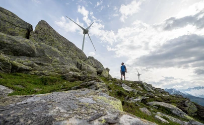
The hiking time is about 3 hours uphill and 2 hours downhill – ideal for families, nature lovers, and everyone who wants to discover the alpine landscape with new eyes.
- 4:10 h
- 11.45 km
- 840 m
- 48 m
- 1,097 m
- 1,898 m
- 801 m
- Start: Göschenen station
- Destination: Göscheneralp dam
Good to know
Pavements
Best to visit
Directions
Göschenen - Lauenen – Bonen – Gwüest - Dam
Tour information
Nature Highlight
Stop at an Inn
Tour with Dog
Directions & Parking facilities
Göschenen is easy and quick to reach thanks to direct access to the A2 motorway. The Göscheneralp is also easily accessible and can be reached via the main road from Göschenen without any problems.
There are various parking options in the Göscheneralp valley as well as in the village of Göschenen.
Göschenen is conveniently accessible by train or bus: SBB timetable. From there, you can continue by bus to the Göscheneralp: Auto AG Uri timetable.
Additional information
You can find all information about the water route and the individual stations here.
Author
Andermatt-Urserntal Tourismus GmbH
Organization
Région de vacances Andermatt

Nearby


