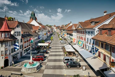
Willisau - Menzberg


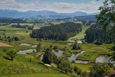
From the old town, the path passes the Landvogteischloss and goes through the sports facilities towards Chalchtaren. After a steep ascent, the beautiful view of the diverse Napf foreland surprises. On one of the many ridges of a Napf foothill, you hike via Mettenberg over a beautiful plateau to Mörisegg, a former retirement home.
At 950 m above sea level, you can see the uniquely designed mountain chapel St. Joder, called "Tioderchäppeli" by the locals. Soon, the highest point of the hike, Oberlehn, is reached. To the southwest, on a prominent hill, there is a lime tree with seating and an information board that informs hikers about the panorama and the geographical sights.
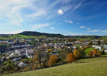
Soon you will see Menzberg, the highest village on the Napf with about 600 inhabitants. At the Kurhaus Hotel, you can refresh yourself excellently before the post bus takes you to Menznau station.
- 4:00 h
- 13.69 km
- 535 m
- 73 m
- 554 m
- 1,089 m
- 535 m
- Start: Willisau Train Station
- Destination: Menzberg Village
Waypoints
Good to know
Pavements
Best to visit
Directions
Willisau - Vorberg - Mörisegg - Underskapf - St. Joder - Oberlehn - Menzberg
Tour information
Familiy-Friendly
Stop at an Inn
Equipment
- Weather-appropriate clothing
- Good footwear
- Hiking poles are recommended
- Camera
- Day backpack
Directions & Parking facilities
Additional information
Author
Willisau Tourismus
Organization
Willisau Tourismus
Author´s Tip / Recommendation of the author
- The short detour to the lime tree at Oberlehn is worthwhile because of the wonderful 360-degree view!
From mid-October to April, you can enjoy the view in Menzberg from one of the seven strand chairs!
- Landgasthof Hotel Menzberg (closed Monday & Tuesday)
Nearby

