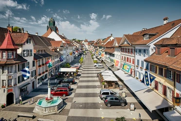
Circular hike around Willisau (Anniversary path)


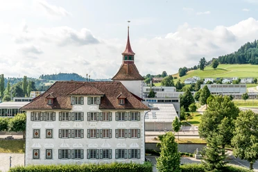
Our hike begins at Zehntenplatz, where the hiking signposts are located. We follow the brown signpost up to the Schlossfeld sports facilities. Soon it goes down again through a residential area, where the next ascent takes us to the St. Niklaus Chapel built by the Habsburgs.
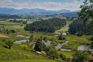
We continue down St. Niklaus hill past HUG company with the Ringli shop and the distillery DIWISA towards the swimming pool. We briefly follow the Jakobsweg until the paths separate again and we pass the start of the Planet path and turn left. Then it goes west towards the Gütsch viewpoint with the distinctive white cross. Afterwards, there is a longer section through the Willbrig forest. Still in the forest, we leave the Jakobsweg and head southwest to Käppelimatt, where an oversized wine bottle indicates the popular Bottle Museum. We cross the cantonal road and follow the babbling Mühlibächli on a narrow footpath back to the starting point of our route.
- 3:00 h
- 11.14 km
- 185 m
- 187 m
- 544 m
- 679 m
- 135 m
Waypoints
Good to know
Best to visit
Directions
Willisau Zehntenplatz - Schlossfeld - Buchwigger - St. Niklaus hill - Seewag - Swimming pool - Sottikebach - Gütsch - Willbrig forest - Gulphütte - Käppelimatt - Eimatt - Mühlibächli - Willisau Zehntenplatz
Tour information
Cultural Interesting
Loop Road
Stop at an Inn
Directions & Parking facilities
Additional information
The path can also serve as inspiration, shortcuts are possible at any time.
We recommend completing the route counterclockwise.
Author
Willisau Tourismus
Organization
Willisau Tourismus
Author´s Tip / Recommendation of the author
Visit the Old Town of Willisau
Alternatives for bad weather
Nearby


Download GPX file