Benediktusweg


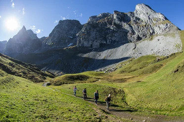
The Benediktusweg forms a connection from Engelberg Monastery to Maria-Rickenbach Monastery. The route is very varied and offers a beautiful panorama of the valley and the mountains.
The path runs with some steep intermediate climbs at half height above the eastern valley side of the Engelberger Aa and offers very impressive views into the side valleys, peaks and glacier regions of the Unterwalden Alps. The mountain village Oberrickenbach marks the lowest point of the hike.
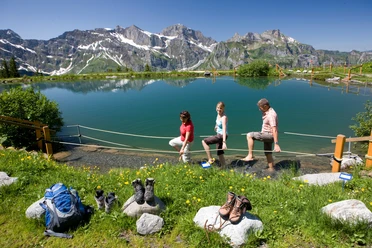
Niederrickenbach is also known as a pilgrimage site and monastery village "Maria-Rickenbach." For many devout people, it is a center of comfort and strength. Naturally managed alpine meadows, wild mountain pastures, rugged rocks and a magnificent panoramic view characterize the landscape of Niederrickenbach. A visit to the alp tavern Musenalp is highly recommended.
The best viewpoint is reached at the Rosenbold ridge height. From there, the entire Engelberg Valley can be seen from above.
- 8:45 h
- 21.29 km
- 1,750 m
- 1,750 m
- 858 m
- 1,886 m
- 1,028 m
- Start: Engelberg, train station
- Destination: Niederrickenbach
Waypoints
Good to know
Best to visit
Directions
Tour information
Stop at an Inn
Organization
Engelberg-Titlis Tourismus
Author´s Tip / Recommendation of the author

Nearby


