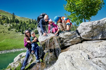
Chänzeliweg


From the mountain station of the funicular railway with the steepest funicular railway in the world you reach the car-free mountain village of Stoos. Then follow the signposts to the ascent to the Fronalpstock. Past the piste restaurant Welesch to the middle station Mettlen and further up. Via Charenstöckli it goes uphill to the viewpoint up to the Fronalpstock.
- 2:15 h
- 2.70 km
- 397 m
- 3 m
- 1,510 m
- 1,922 m
- 412 m
- Start: Stoos, mountain station funicular railway
- Destination: Stoos, mountain station funicular railway
Waypoints
Good to know
Pavements
Best to visit
Directions
Stoos- Welesch - Mettlen - Charenstöckli - Fronalpstock
Tour information
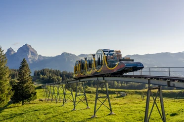
Mountain Railway Tour
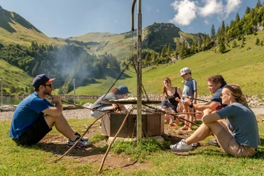
Stop at an Inn
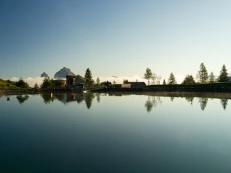
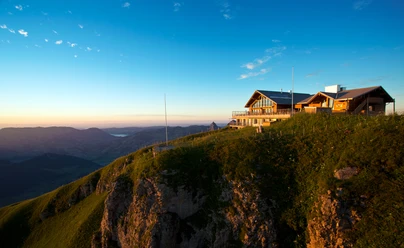
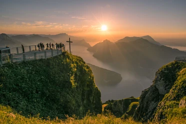
Summit
Equipment
Hiking boots with good grip or trekking shoes, rain jacket, beverage, food, possibly sticks.
Directions & Parking facilities
By car on the A4 to the Schwyz exit, then towards Muotathal to the valley station of the large funicular railway Schwyz-Stoos or turn off onto Morschacherstrasse (at Wolfsprung), follow the signs to Morschach and continue to the valley station of the small aerial cableway Morschach-Stoos.
Parking is available at the valley stations of the funicular railway Schwyz-Stoos and the aerial cableway Morschach-Stoos.
By train to Schwyz-Seewen station, then by bus to the valley station of the large funicular railway Schwyz-Stoos (line 501 Schwyz - Muotathal) or by train to SBB Brunnen station, then by bus to the valley station of the small aerial cableway Morschach-Stoos.
Additional information
Stoosbahnen AG: 041 818 08 08
Chairlifts Fronalpstock operate daily in the main season and on fine weekends in the off-season.
Literature
Hiking map Region Stoos-Muotatal (available at all Stoosbahn stations)
Author
Stoos-Muotatal Tourismus / Schwyzer Wanderwege
Organization
Schwyzer Wanderwege
Author´s Tip / Recommendation of the author
Frönelis Geissli playground & petting zoo on the Fronalpstock.
Safety guidelines
Please hike along the marked and secured hiking routes.
Map
Schwyz hiking maps are available at the Regio Shop at the valley station of the funicular railway:

Nearby