Circular route from Ratzi via Geissgrätli to Kinzigpass

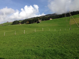
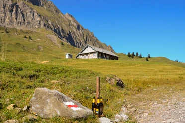
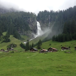
The landscapes we cross from Ratzi are diverse. Along traditional mountain farms, we reach the Obere Gisleralp after a romantic mountain forest, one of the few private alpine pastures in the canton of Uri. We cross the alpine meadows and are soon at the Geissgrätli, where five large benches invite you to rest. From there it is another twenty minutes over the ridge to the historic Kinzigpass. The descent then leads back to Ratzi via a well-developed hiking trail.
- 3:30 h
- 8.93 km
- 646 m
- 614 m
- 1,517 m
- 2,125 m
- 608 m
- Start: Spiringen
- Destination: Geissgrätli and Kinzigpass
Good to know
Pavements
- Unknown (7%)Asphalt (2%)Gravel (3%)Trail (30%)Path (58%)
Best to visit
- suitableDepends on weather
Tour information
Circular trail
Directions & Parking facilities
- Getting thereBy car, we reach the "Altdorf Süd/Erstfeld" exit via Axen and highway A2. Since traffic often jams in Altdorf, it is worthwhile to bypass Altdorf this way. After the exit, we turn north, cross Schattdorf, and turn towards Klausen at the second roundabout. The road rises towards Bürglen. Soon we reach Spiringen.ParkingThere are enough parking spaces at the valley station of the Ratzi mountain cable car.Public transportationWith the post bus, we comfortably reach Spiringen from Altdorf. The valley station of the Ratzi mountain cable car is located immediately at the post bus stop in Spiringen.
Additional information
- www.ratzi.ch
www.ratzi-berggasthaus.ch
http://www.naturfreundehaeuser.ch/rietlig/herzlich-willkommen/
Author
Markus Fehlmann
Organization
Verein Urner Wanderwege
Author´s Tip / Recommendation of the author
- Take more time for this hike than strictly necessary. This way you can better enjoy the panorama and at the same time discover many natural beauties.

Nearby
Download GPX file