Fluonalp - Dundelegg


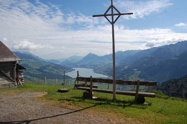
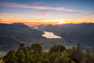
From the parking lot, a farm road leads to the Fluonalp huts and further eastwards to Rieben. From here, it goes uphill to the large, solitary mountain hut Schwantelen. Soon, the magnificent viewpoint Sädel is reached via the alpine path. It offers views of Lungerersee, Sarnersee, and Alpnachersee as the Obwalden arm of Lake Lucerne. The entire Sarneraatal from Brünig to Lopper lies at your feet.
From here, the hike proceeds westwards along an old border wall between Giswil and Lungern to Dundelegg. This again offers a wonderful view of the Bernese Alps and the Haslital. The mountain path then turns northwards over alpine pastures back to the starting point.
- 1:27 h
- 4.65 km
- 194 m
- 191 m
- 1,552 m
- 1,742 m
- 190 m
- Start: Alpkäserei Fluonalp
- Destination: Alpkäserei Fluonalp
Good to know
Best to visit
Tour information
Loop Road
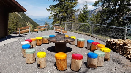
Stop at an Inn
Equipment
Directions & Parking facilities
On the A2 from Lucerne, switch in the tunnel to the A8 towards Interlaken, Sarnen, continue driving until Giswil.
From Interlaken via Brünig on the A8 to the Giswil exit.
From Giswil, 7 km along the panoramic road towards Mörlialp to the signposted Pörterwald junction. From here an alpine road leads to the Alpbeizli & Alpkäserei Fluonalp.
By PostBus from Giswil to the Pörterwald stop. Hiking time to Fluonalp 1 hour 50 minutes.
Note that the bus runs only from mid-June to the end of October, 3 times daily. See www.postauto.ch
Author
Obwalden Tourismus
Organization
Obwalden Tourismus

Nearby
Download GPX file