From Fräkmüntegg via Heitertannli Trail and Klimsen Saddle to Pilatus Kulm

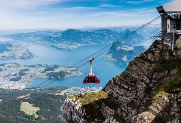
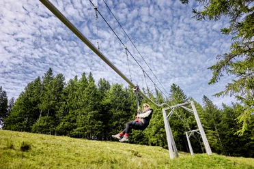
From Fräkmüntegg mountain station, the trail passes the Fräkigaudi toboggan run and crosses the pastures of Alp Ober Lauelen to the hut (1,332 m). The view opens to the steep slope where the Heitertannli Trail crosses a stream and climbs between rock steps. In summer, alpine flowers bloom along the route, including white daffodils. Strict plant protection applies throughout the Pilatus area and is monitored by Pro Pilatus. The path continues to Klimsen Saddle (1,866 m) with its small chapel. Each June, the Grotzlianer group from Malters clears snow and debris. The final ascent takes about 45 minutes via the west face and Chriesiloch to Pilatus Kulm (2,119 m).
- 2:40 h
- 3.83 km
- 797 m
- 142 m
- 1,334 m
- 2,119 m
- 785 m
- Start: Fräkmüntegg
- Destination: Pilatus Kulm
Good to know
Best to visit
- suitableDepends on weather
Tour information
Refreshment stop
Equipment
- Sturdy footwear, a rain jacket and sufficient drinking water are essential for every hike.
Directions & Parking facilities
- Getting thereTake the A2 to the Lucerne Kriens exit, follow route 2a to Apotheke Spani, turn left and continue to the Kriens panoramic gondola valley station.ParkingAt the valley station of the Kriens panoramic gondolaPublic transportationTake the SBB train to Kriens Mattenhof station, then continue by bus to the Pilatus Railways.
Author
Luzern Tourismus
Organization
Lucerne Tourisme
Author´s Tip / Recommendation of the author
- From Pilatus Kulm, the beautiful Flower Trail continues to Tomlishorn (2,128 m) for those who wish to climb even higher.