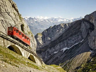
Alpnachstad - Renggpass - Fräkmüntegg

From the Pilatus cog railway valley station in Alpnachstad, the trail leads past Grossrüti (614 m), straight across the Wolfortbach stream and through the forest northeast up to the Rengg Pass (886 m). From the Rengg Pass, the route heads northwest down to Hinter Rengg (790 m), passes the Alpgschwänd mountain restaurant and then continues uphill via Gschwänd to Fräkmüntegg (1,416 m).
- 3:30 h
- 7.83 km
- 1,135 m
- 162 m
- 436 m
- 1,410 m
- 974 m
- Start: Alpnachstad
- Destination: Fräkmüntegg
Good to know
Best to visit
suitable
Depends on weather
Equipment
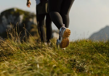
Sturdy footwear, a rain jacket and sufficient drinking water are essential for every hike.
Directions & Parking facilities
Getting there
Take the A8 motorway to the Alpnach exit.
Parking
At the valley station of the Pilatus cog railway
Public transportation
Take the SBB to Alpnachstad railway station.
Author
Luzern Tourismus
Organization
Lucerne Tourisme
Author´s Tip / Recommendation of the author
If you are up for more adventure, visit the Pilatus Rope Park near Fräkmüntegg before heading home, with ten courses of varying difficulty.

Nearby