From Stoos into the Muotatal


We cross the village of Stoos on the way towards Wannentritt - Muotathal. At the last houses we take the turnoff towards "Holibrig" to gain height for the first time and let our gaze wander into the distance. During the first part of the hike, the Mythen dominate the panorama. After the Metzg alp, the signpost "Rinderchruteren" leads us down to the Chruteren forest. Here the forest repeatedly shows itself as a striking contrast to the gentle alpine meadows. Due to the terrain strongly intersected by karst rocks, the forest remained as it was not suitable for clearing for alpine pastures.
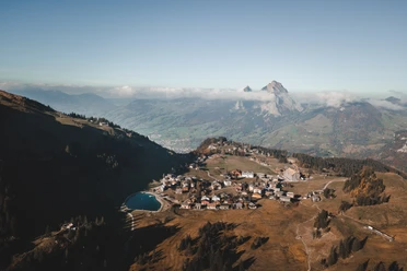
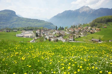
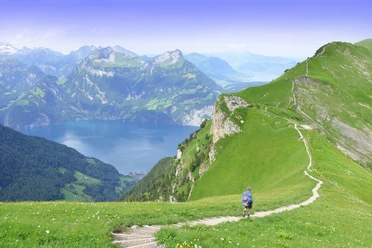
At the Bärhalten alp, looking back offers a magnificent panorama of the Stoos Alps and forward into the Muotatal. The path continues over the Füdlen and Laubgarten alps to Wannentritt, again with changing views. From Wannentritt, we see the impressive Chaiserstock chain. The soft terrain formations of the Stoos Alps are replaced by rugged limestone rocks.
Down to the valley, we choose the path north around the Schwarzstock. Through the shady forest, we reach the Höch Weidli, a natural viewing balcony over the Muotatal. Just below, we experience a different terrain topography for the first time while passing a rock band. Before alpine and forest roads were built, these were the connecting paths between alpine settlements and the village. At the Frutt, we again choose an old connecting path between the settlements and take the hiking route over the Wissenwand to the lower Flüelen into the valley. The impressive path through the field bands of Unter Wissenwand was also the school route for the Wissenwand children in earlier times!
- 4:48 h
- 14.31 km
- 536 m
- 1,375 m
- 608 m
- 1,621 m
- 1,013 m
- Start: Mountain station funicular Schwyz-Stoos
- Destination: Muotathal
Waypoints
Good to know
Best to visit
Directions
Tour information
Nature Highlight
Stop at an Inn
Summit
Equipment
Directions & Parking facilities
By car on the A4 to the Schwyz exit, then towards Muotathal to the valley station of the large funicular Schwyz-Stoos or turn off at Morschacherstrasse (near Wolfsprung), then follow the signs to Morschach and continue to the valley station of the small aerial cableway Morschach-Stoos.
Parking is available at the valley station of the funicular Schwyz-Stoos and the aerial cableway Morschach-Stoos.
Take the train to Schwyz-Seewen station, then the bus to the valley station of the large funicular Schwyz-Stoos (line 501 Schwyz - Muotathal) or take the train to SBB station Brunnen, then the bus to the valley station of the small aerial cableway Morschach-Stoos.
Additional information
Stoosbahnen AG, 041 818 08 08
Literature
Hiking map of the Stoos-Muotatal region (Available at all Stoosbahn stations).
Author
Stoos-Muotatal Tourismus
Organization
Stoos-Muotatal Tourismus
Author´s Tip / Recommendation of the author
Safety guidelines

Nearby


