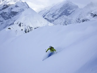
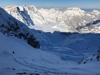
Galtiberg


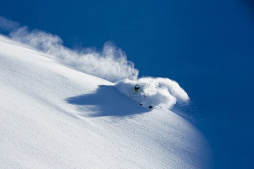
The descent from Titlis to Engelberg via the Galtiberg Glacier is the longest, most alpine and most difficult descent in the Titlis area. It is one of the longest variant descents in the Alps. The experience of skiing below the steep Titlis north face is impressive but only reserved for very skilled freeriders.
Notes
- Descent from 3020m above sea level to 1020m above sea level.
- Alpine descent! The "Traverse" is dangerous and extends over a cliff with high risk.
- The "Graben" couloir is a dead end!
- It is strongly recommended to hire a mountain guide.
- 0:35 h
- 7.97 km
- 2 m
- 1,959 m
- 1,081 m
- 3,040 m
- 1,959 m
- Start: Titlis mountain station 3020 m above sea level
- Destination: Fürenalp valley station 1080 m above sea level
Good to know
Best to visit
suitable
Depends on weather
Directions
Klein Titlis-Galt Glacier-Galtiberg-Bödmen-Herrenrüti-Fürenalp Valley Station
Equipment
Equipment can be rented at the sports shops in Engelberg.
Directions & Parking facilities
Getting there
By car, you drive on the A2 (Basel-Gotthard) to Stans South, then 20 km on the main road to Engelberg. Engelberg is 30 minutes from Lucerne, 1 hour and 15 minutes from Basel, Zurich or Bern.
Parking
Parking is available in Engelberg for a fee.
Public transportation
National and international connections (from Zurich Airport connections every half hour with approx. 1h travel time) to Lucerne. Then by the Zentralbahn in 43 minutes through varied landscapes and gorges up to Engelberg.
Additional information
Author
Engelberg - Titlis Tourismus
Organization
Engelberg-Titlis Tourismus
Author´s Tip / Recommendation of the author
Safe snow fun in the powder snow at the Snow & Safety Days.
Safety guidelines
Safety tips for freeriding in the open terrain
- Please note that you are touring at your own risk!
- A descent must be carefully planned.
- Appropriate equipment (avalanche transceiver, probe, shovel, airbag) and clothing are an essential safety factor
- The local ski and mountain guides will safely lead you to your destination and back home.
- Emergency call REGA number 1414

Nearby