Panorama Bike stage 6: Einsiedeln – Schwyz


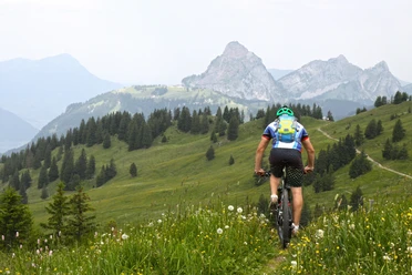
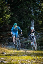
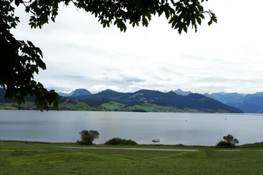
The stage from Einsiedeln to the Alptal rolls leisurely on secondary and main roads to Brunni. Here begins the ascent to the Haggenegg, a hiking paradise of a special kind! Not without reason, because here opens up a panorama of unique character: Lake Lauerz, Rigi, Lake Lucerne and the Mythen.
With this view at your side, it is a particular pleasure to head for the descent to Schwyz.
Highlights:
- Einsiedeln
- Haggenegg
- Schwyz
Note(s)
«Panorama Bike» is a route marked by SchweizMobil that crosses Switzerland diagonally from northeast to southwest. In 14 stages, it runs nearly 470 kilometers with over 15,000 meters of ascent from Rorschach on Lake Constance via Central Switzerland and the Bernese Oberland to Montreux on Lake Geneva.
The route is signposted with the red MTB signs «2» and can also be ridden in the opposite direction.
- 2:30 h
- 24.89 km
- 607 m
- 1,001 m
- 515 m
- 1,414 m
- 899 m
- Start: Einsiedeln, station
- Destination: Schwyz
Good to know
Best to visit
Directions
Tour information
Stop at an Inn
Equipment
- Mountain bike
- Water bottle
- Helmet
- Possibly bike map
- Mobile phone
Directions & Parking facilities
To Einsiedeln / SZ:
- Take exit no. 39 (Schindellegi) from the A3 motorway from Chur or no. 37 (Richterswil) from Zurich.
- From Lucerne, Zug, Schwyz, Gotthard to Schwyz and the cantonal road no. 8 via Sattel - Rothenthurm - Biberbrugg to Einsiedeln.
Brüel car park in Einsiedeln (paid)
By train...
- from Zurich via Wädenswil to Einsiedeln station.
- from Lucerne by train via Biberbrugg to Einsiedeln station.
Additional information
Author
Einsiedeln-Ybrig-Zürichsee Tourismus
Organization
Bikegenoss Zentralschweiz
Author´s Tip / Recommendation of the author
- Start in Einsiedeln mit Kaffee im DreiHerzen, oder Einkehrmöglichkeiten direkt im Kantonshauptort Schwyz.
Ab dem höchsten Punkt warten zusätzliche Singletrail-Optionen.
Safety guidelines
Nearby


