Snowshoe trail 880: Göschenen


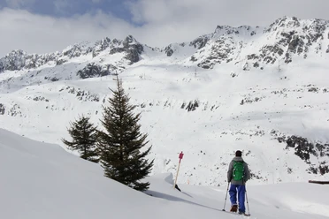
Lonely winter landscapes and a fairytale forest lure on the snowshoe trail towards Göscheneralp. The start is in the railway village of Göschenen.
The easy snowshoe trail starts near the Göschenen hydroelectric power station, which can be visited by appointment. It initially leads along the Göschenerreuss, a tributary of the Reuss that originates at the Chelengletscher. Noticeable: The chapel on the other side of the river near the hamlet of Abfrutt. It is dedicated to the avalanche patron Matthias.
On the return route through the snowy Bitziwald, the highest point above Ängi is reached (1194 m above sea level). Finally, it goes downhill again: first gently and, after a hairpin turn, somewhat steeper, heading to the destination at the hydroelectric power station.
- 1:02 h
- 2.72 km
- 91 m
- 94 m
- 1,100 m
- 1,194 m
- 94 m
- Start: Göschenen
- Destination: Göschenen
Good to know
Pavements
- Unknown (34%)Street (5%)Trail (59%)Path (2%)
Best to visit
- suitableDepends on weather
Directions
- Göshenen Fang - Fangli - Bitzi - Ängi - Stafel - Bitziwald - Stockwald - Fängli - Göschenen Fang
Tour information
Circular trail
Refreshment stop
Equipment
- Snowshoes, binoculars
Directions & Parking facilities
- Getting thereBy car, drive towards Gotthard. At Göschenen, leave the motorway and enter the village of Göschenen.ParkingAt the entrance to the village, you will find plenty of parking spaces along the railway tracks.Public transportationGöschenen is easily accessible by train.
Additional information
Author
Markus Fehlmann
Organization
Verein Urner Wanderwege
Author´s Tip / Recommendation of the author
- Combine the snowshoe hike with a special bathing and fondue session at the Wasserwelten Göschenen.
Map
Nearby

Download GPX file