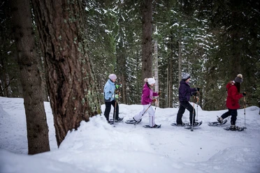
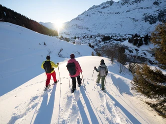
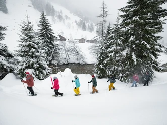
Snowshoe trail 875: Andermatt


The circular route starts at the village bridge in Andermatt and leads towards Unteralptal to Mettlen. There is the highest point of the route and its turning point, suitable for a short break. From here, you have a view of the icefall of the Gurschenbach. On the way back, you cross the Gurschen ski run and pass the Schützenhaus Brunnen. It's worth looking into the valley here: it extends to Hospental and the Schöllenen. Past the Mariahilf chapel, it goes back to the starting point.
- 1:13 h
- 2.93 km
- 142 m
- 143 m
- 1,446 m
- 1,589 m
- 143 m
Good to know
Pavements
Unknown (65%)
Trail (35%)
Best to visit
suitable
Depends on weather
Directions
Mülematte - Fliessgden - Vorder Holzli - Hinter Holzli - Mettlen - Brunnen/Fliessmatt - Mühlematte
Tour information
Loop Road
Equipment
Snowshoes
Directions & Parking facilities
Getting there
By car, you can use the motorway up to Göschenen. In Göschenen, leave the motorway and take the exit towards Gotthard. You climb the Schöllenenschlucht and reach Andermatt in a few minutes.
Parking
There is a parking lot at the Gemsstockbahn at the very end of the village.
Public transportation
You can easily reach Andermatt by train. You need to change from the SBB to the Matterhorn Gotthard Bahn in Göschenen.
Additional information
Author
Markus Fehlmann
Organization
Verein Urner Wanderwege
Author´s Tip / Recommendation of the author
Visit Kiosk 61. Bänz Simmen can tell you a lot about Andermatt.
Safety guidelines
None
Map
Nearby


Download GPX file