Sörenberg-Glaubenbielen-Sörenberg


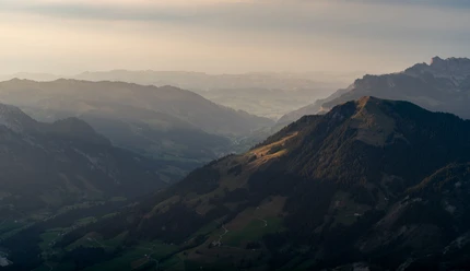
This circular route starts in the village centre of Sörenberg and leads along the southwestern valley flank. The path runs below the Hagleren and Rotspitz, with nice views into the valley and on the surrounding hills.
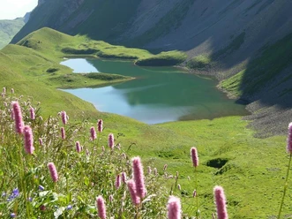
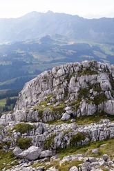
At first, it goes steadily slightly uphill over alpine pastures and forest paths towards Glaubenbielen Pass. The path is well marked and mostly runs on pleasant natural trails. Along the way, scenic spots invite you to stop repeatedly – with views of the Schrattenfluh or the Brienzer Rothorn range.
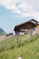
At the Glaubenbielen Pass you reach the highest point of the route. From here you have a wide view towards Obwalden and the surrounding mountain scenery. The return path leads over the gently sloping Schönenboden, where the typical pre-alpine cultural landscape with pastures, scattered alpine huts and forests shows itself.
Finally, you return over comfortable paths back to Sörenberg.
- 4:00 h
- 12.77 km
- 496 m
- 482 m
- 1,151 m
- 1,632 m
- 481 m
- Start: Sörenberg village
- Destination: Sörenberg village
Waypoints
Good to know
Pavements
Best to visit
Tour information
Loop Road
Nature Highlight
Equipment
Good footwear, rain jacket & enough drinking water for the way are part of every hike.
More tips for safe hiking, information on suckler cow herds and livestock guardian dogs and much more can be found on the website of Schweizer Wanderwege.
Author
Sörenberg Flühli Tourismus
Organization
UNESCO Biosphäre Entlebuch
Author´s Tip / Recommendation of the author
To shorten the route you can use the PostBus from the Glaubenbielen parking lot back to Sörenberg.

Nearby


Download GPX file