Surenen Pass: Brüsti - Engelberg


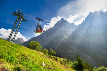
The ride with the Attinghausen - Brüsti cable car alone is a unique experience. Nowhere is the view of the Reuss Valley and the Schächen Valley more beautiful!
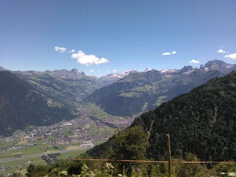
The hike starts leisurely. On the sunny terrace at Brüsti, you can refresh yourself once more with a coffee in one of the mountain inns. It then slowly ascends through the last fading forests up into the alpine area. At Nossenboden, we find a family-friendly barbecue area with running water and toilets. At Alp Grat, we encounter a typical Uri alpine farm with a mountain inn. Then we turn left towards the Surenen Pass.
After Geissrüggen, a first steep climb awaits us. Here at Angistock, we take a short break and refresh ourselves. Then we walk on a flat section again before the second ascent brings us up to the Surenen Pass. After Angistock, we come to Langschnee, where there is usually still snow even in summer. Here it is advisable to follow the marked path and not take the direct trail over the scree slope. The danger of falling rocks from the nearby Brunnistock is not to be underestimated. After a strenuous climb, the highest point of the pass hike, the Surenen Pass, is reached.
The Surenen Pass offers a magnificent view: on one side to the Schächen Valley Alps and on the other side to the Titlis. Slightly below the pass lies the mountain hut. The descent leads past the Blackenalp to Stäuber, where according to legend the bull defeated the Greiss (monster) of Surenen. There the trail branches.
The valley station of the Fürenalpbahn can be reached either via the path down to Stäfeli and Alpenrösli or via the Äbnet and the Fürenalp. If you want, a shuttle bus from the Fürenalpbahn will take you to Engelberg.
(Shuttle bus valley station Fürenalp to Engelberg: Titlis Taxi, Engelberg +41 (0)79 / 903 93 73)
- 6:59 h
- 20.69 km
- 806 m
- 1,320 m
- 1,007 m
- 2,281 m
- 1,274 m
- Start: Brüsti, Attinghausen
- Destination: Engelberg
Good to know
Pavements
Best to visit
Directions
Tour information
Cultural Interesting
Nature Highlight
Stop at an Inn
Equipment
Good hiking shoes, day backpack, head covering in summer, rain protection, binoculars.
Take the hiking map of the canton of Uri, Lake Uri sheet with you!
Directions & Parking facilities
Additional information
Every mid-August, the guided Surenen hike from Attinghausen Tourism has been taking place for years. Nature lovers will be surprised with many small attractions on the hike.
Book your accommodation in the Uri holiday region here: booking.uri.info
Find experiences in the Uri holiday region here: uri.swiss
Author
Markus Fehlmann
Organization
Verein Urner Wanderwege
Author´s Tip / Recommendation of the author
Safety guidelines
Map

Nearby


