Via Urschweiz, 2nd stage


From the village of Isenthal, we hike westward out of the village. Along the wild village brook and past magnificent farms, we stroll into the valley over steep hay meadows with rare alpine flowers, colorful butterflies, and wild animals up to the remarkable St. Jakob Chapel.
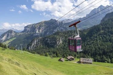
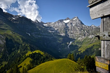
From here it goes steeply upward on the old cattle trail to the year-round inhabited alpine settlement Gitschenen at 1550 m above sea level. Besides the mountain station of the aerial cableway, there are also various accommodation and dining options here. A visit to the modern Betruf Chapel, the alpine herb garden, or a walk on the nature trail is worthwhile. The management of the wild and steep meadows under the rugged rock walls earned the mountain farmers of Isenthal the title "Landscape of the Year 2016."
- 3:13 h
- 8.44 km
- 869 m
- 99 m
- 776 m
- 1,547 m
- 771 m
- Start: Village Isenthal
- Destination: Mountain station of the Isenthal - Gitschenen aerial cableway
Good to know
Pavements
Best to visit
Directions
Tour information
Cultural Interesting
Nature Highlight
Stop at an Inn
Equipment
Directions & Parking facilities
Additional information
Author
Markus Fehlmann
Organization
Verein Urner Wanderwege
Author´s Tip / Recommendation of the author
Safety guidelines

Nearby
