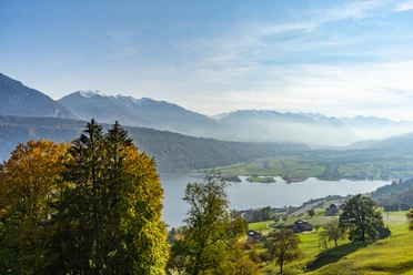
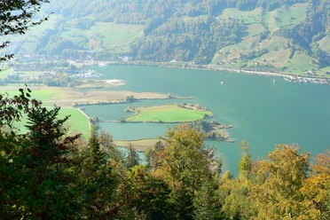
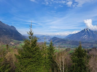
Waldstätterweg Stage 5: Alpnachstad - Bürgenstock


Through the Alpnachstader Ried and the Rotzloch Gorge to the Schnitzturm in Stansstad. Ascent along the abandoned tracks of the Fürigenbahn to Oberschilt and steeply up to the Bürgenstock, with views of Pilatus and the Mittelland.
The Waldstätterweg is continuously marked as a regional route of the SchweizMobil network and signposted as Route No. 98 in both directions.
- 4:45 h
- 15.13 km
- 768 m
- 330 m
- 433 m
- 965 m
- 532 m
- Start: Alpnachstad, train station
- Destination: Bürgenstock
Waypoints
Good to know
Best to visit
Directions
Additional information
Luzern Tourismus AG
Tourist Information
Zentralstrasse 5
CH-6002 Luzern
Tel.: +41 (0)41 227 17 17
E-Mail:
Internet: www.luzern.com
Association Weg der Schweiz & Waldstätterweg
Office Brunnen Tourism
Bahnhofstrasse 15
CH-6440 Brunnen
Tel.: +41 (0)41 825 00 40
E-Mail:
Information about the Waldstätterweg: www.waldstaetterweg.ch
Author
Carla Hendry
Organization
Lucerne Tourisme

Nearby
