With endurance to Chinzig Chulm


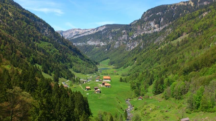
The Chinzig Chulm has recently become an insider tip among bikers. Although it has been crossed for over 4000 years, the pass only entered history with the passage of the Russian General Suvorov in 1799. Although the pass can be reached directly from both sides, this hike offers an endurance challenge and the ascent can be started from the Bisistal. Above the Schwarzenbach restaurant, a mountain road branches off to the right. This leads us to the Alp Galtenäbnet, located at 1350 m, assigned to Uri during the border adjustment. With the chapel and the huts, the alpine village creates a picturesque scene on the moorland plateau. During the ascent, we leave the road and take the red-marked alpine path from Stäfeli, which leads us to Galtenäbnet.
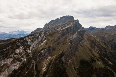
The path to Rindermatt, roughly at the same altitude as Galtenäbnet, is very varied through a small mountain pass, a high-level trail and an impressive moorland. The views on the one hand of the Schwyz and Glarus side with Pfannenstock, Grisset, Bös Fulen, Glärnisch and on the other hand of the Uri side with the Chaiserstock range and the Uri Rotstock are worth mentioning. Although an alpine road leads to Rindermatten, we follow the marked path to the Chinzig. There, a small sign at the signpost points out that the descent follows the Suvorov path. You have the option to walk on the road or choose the old path, which often runs near the Hüribach and past springs and old settlements.
On the final stage from Liplisbüel down to Muotathal, it is the deeply eroded gorges of the Hüribach, the roaring waterfalls and glacial mills, as well as the mystical forest, that make you forget the tiredness of this long route.
- 9:24 h
- 27.45 km
- 1,665 m
- 2,015 m
- 626 m
- 2,073 m
- 1,447 m
Good to know
Pavements
Best to visit
Tour information
Stop at an Inn
Summit
Directions & Parking facilities
Additional information
Author
Stoos-Muotatal Tourismus
Organization
Stoos-Muotatal Tourismus

Nearby

