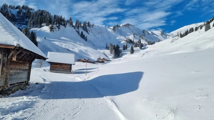
Brünigpass - Ober Brünig - Lungern


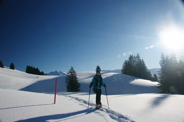
The Brünig Pass was already an important north-south connection across the Alps for the Romans. The hike initially passes south of the pass by the watchtower up to the Brüniger Älpeli. Through the once disputed border area with alternating terrain basins and forest sections. The path continues through the Schäriwald around Gspan.
Crossing the cantonal border, you reach Ober Brünig in Obwalden and from one snow-rich valley to another the Rüti. At the hunter’s hut, a boundary stone from 1785 decorated with the coats of arms of both cantons (probably relocated) recalls old times.
Green signs indicating the wildlife sanctuary remind you not to leave the path, which now overcomes the Letzi and leads down to the cantonal road. From there, the route goes via the Balmiflue to the rest area by the castle chapel. Natural forest windows repeatedly offer magnificent views of the Sarneraatal up to Pilatus and the Lungerersee nestled between the mountains as well as the village of Lungern. A little road then leads down from there to Lungern station, halfway passing the “Wätterloch”: if cold air flows out, it indicates good weather; with warm air, there is rain!
- 3:09 h
- 7.72 km
- 207 m
- 460 m
- 752 m
- 1,212 m
- 460 m
- Start: Brünig
- Destination: Lungern
Good to know
Best to visit
Directions & Parking facilities
Additional information
Author
Obwalden Tourismus
Organization
Luzern Tourismus
Safety guidelines
The snowshoe route and description were developed in collaboration with local mountain and tour guides. It is merely a suggested route and is neither signposted nor protected from alpine hazards. It does not pass through wildlife protection areas and avoids obvious danger spots under good snow and avalanche conditions.
Proper preparation for the route with suitable equipment is essential. Information about the current avalanche situation can be found at the links below.
Participation in the route is at your own risk. Obwalden Tourism disclaims any liability for personal or property damage on the proposed snowshoe route.
Nearby