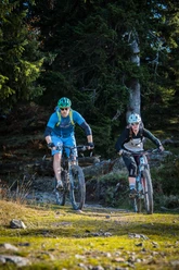
Hoch-Ybrig Bike


The start and end point of this bike route is the pilgrimage site Einsiedeln with its imposing monastery. At the center is Hoch-Ybrig: A trip to the ski area on the gates of Zurich is also worthwhile in summer. A break is also worth it for the panoramic view from the highest point of the route: the Spirstock. In good visibility, the diversity that characterizes the region is revealed – mountains, lakes, meadows, snow, and water.
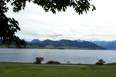
The high route above Lake Sihl with views all the way to Zurich initially leads to Unteriberg, where the valley floor is crossed. After the Waag river, the biggest challenge of the route begins: the steep climb via a country road to Oberiberg. In the sunny spa town, liquid reserves can be replenished at the village fountain. Then the demanding ascent along the Roggenstock ski lift is tackled.
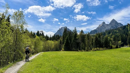
The steepest section is now overcome, but it goes even higher. The path leads on gravel roads past the idyllic Seeblisee lake, which invites fishing. The highest point of the route, the Spirstock, offers a beautiful view of the two Schwyz home mountains, the Grosser and Kleiner Mythen. Along the ridge through the high and low moor areas of Ibergeregg, the Mythen mountains come closer until they rise directly in their full size at Brunni. Downhill the path finally leads back to the monastery village of Einsiedeln.
- 4:30 h
- 55.38 km
- 1,578 m
- 1,578 m
- 882 m
- 1,760 m
- 878 m
- Start: Einsiedeln
- Destination: Einsiedeln
Good to know
Pavements
Best to visit
Directions
From Einsiedeln station, follow the Hoch-Ybrig Bike 967 signposting
Tour information
Loop Road
Directions & Parking facilities
Additional information
In der Zentralschweiz teilen wir uns viele Wege mit Wandernden, Familien oder anderen Naturnutzenden. Mit einem freundlichen Gruss, angepasster Geschwindigkeit und gegenseitigem Respekt sorgen wir gemeinsam dafür, dass Biken hier auch in Zukunft möglich bleibt. Danke, dass du fair unterwegs bist.
Author
Einsiedeln-Ybrig-Zürichsee Tourismus
Organization
Bikegenoss Zentralschweiz
Safety guidelines
- Push/carriage section: Tubenmoos moor area – Adlerhorst, approx. 5 – 10 minutes.
- Attention: The steep section (possible carrying passage) up to Spirstock can be bypassed on the gravel road (turn right at a alp about 200 m before the end of the road).
- E-bikers can avoid the carrying passage. Bypass the moor area towards Roggenegg and the Roggenstock from behind. The routes rejoin near the Fuederegg restaurant in Hoch-Ybrig.
Nearby


Download GPX file