Hospental-Gotthard Pass


The hike starts in the mountain village of Hospental. Hospental is known for the old tower, which also serves as a viewing platform with views over the Ursern Valley. Above the village of Hospental with 150 inhabitants, hikers follow the path on the old pass road, taking a last look at the valley.
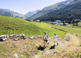
From Gamssteg, the trail leads through alpine meadows, past streams, and is surrounded by steep rock walls. In many places, old stone slab sections from the mule era can be admired. The hike continues to the cantonal border between Uri and Ticino at Brüggloch. From there, hikers follow the old mule track up to the Gotthard Pass height. On the way, it is worth stopping at one of the mountain lakes to fully enjoy the panorama. At the top of the pass, you are then surrounded by the impressive mountain scenery.
- 3:10 h
- 8.80 km
- 656 m
- 18 m
- 1,452 m
- 2,091 m
- 639 m
- Start: Hospental train station
- Destination: Gotthard Pass
Good to know
Pavements
Best to visit
Directions
Tour information
Cultural Interesting
Nature Highlight
Stop at an Inn
Tour with Dog
Equipment
Clothing appropriate for the weather
Good footwear
Drink and provisions
Trekking poles if needed
Directions & Parking facilities
The starting point Hospental can be reached directly by car from different directions. This includes from Central Switzerland via the Schöllenen/Andermatt, over the Oberalp Pass, from Ticino over the Gotthard Pass, or from Valais over the Furka Pass.
A site plan with all parking lots can be found at: Hospental Parking Lots
The starting point Hospental is accessible by the Matterhorn Gotthard Railway train from Andermatt or Oberwald. The timetable is as follows: SBB Timetable
At the destination, a bus will take you back to Hospental. The timetable is as follows: PostBus Timetable
Please note the pass opening times, as the pass is closed in the winter months due to snow and therefore no PostBus service is operating.
Additional information
For further questions, please contact: Andermatt holiday region, +41 41 888 71 00, [email protected]
Author
Andermatt-Urserntal Tourismus GmbH
Organization
Région de vacances Andermatt
Author´s Tip / Recommendation of the author
Safety guidelines
- Hikers should watch the weather forecast in advance, as parts of the hike are above 2000 m (6562 ft) above sea level and, in extreme cases, light snowfall can occur.
- Pay attention to weather forecasts. In the Alps, weather can change rapidly.
Nearby


