Lucerne KulTour in three days


The Lucerne KulTour connects four diverse rural regions of Lucerne: the UNESCO Entlebuch Biosphere Reserve, the Willisau region, Lake Sempach and the Seetal. The route largely follows the signposted Napf and Seetal ‘Heart Loops’, as well as a section of the Herzroute. The route is characterised by its many loops, steep climbs and scenic high-altitude trails, which constantly offer fresh views over the rolling countryside, towards the Alps and across the region’s lakes. Covering around 168 kilometres with an elevation gain of approximately 3,700 metres, the tour is challenging and hilly. Spanning three days, the route still allows plenty of time for breaks, cultural discoveries and regional experiences. The route is particularly suitable for experienced cyclists or for e-bikes.
Stage 1: Along the Napf Heart Loop from Escholzmatt to Romoos
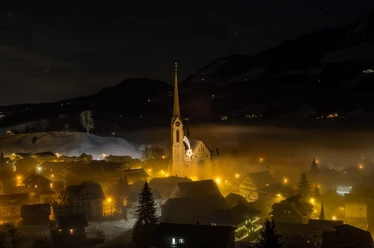
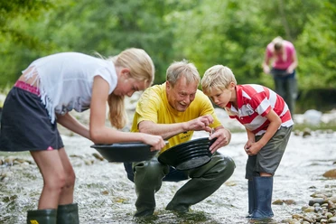
The starting point of the Lucerne KulTour is in Escholzmatt, in the heart of the UNESCO Entlebuch Biosphere Reserve. From here, the route follows the Napf Heart Loop through the characteristic hilly landscape of the Entlebuch. Wooded ravines, open hillsides, small hamlets and sweeping views characterise the first day of the tour. The destination for this stage is Romoos, a village with a vibrant charcoal-burning tradition and a special connection to ‘Napfgold’ (gold from the Napf). At the Grosse Fontanne, visitors can try their hand at gold panning as a regional experience. Those wishing to round off the day with additional panoramic views can continue uphill to Schwesteregg, above Romoos.
Stage 2: From Romoos via Willisau to Lake Sempach
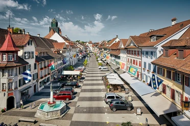
The second stage is the highlight of the tour. From Romoos, the route leads over scenic hills and the Menzberg towards Willisau. Some of the climbs are challenging, but you’ll be rewarded with sweeping panoramic views. On a clear day, the view stretches from the Säntis to the snow-capped peaks of the Bernese Alps. In Willisau, it’s well worth taking a break in this historic little town. The route then follows the Herzroute onwards towards Lake Sempach. The Rottal valley brings a change of scenery: ponds, fields, chapels and peaceful rest stops characterise this section. At the day’s destination around Sempach and Eich, the lakeshore, the old town and the atmospheric backdrop of Lake Sempach await.
Stage 3: From Sempach via the Seetal East Branch of the Herzschlaufe to Lenzburg
The third stage continues from Sempach along the Seetal branch of the Herzschlaufe. A good place to start is with a stop at the Swiss Ornithological Institute in Sempach. The route then passes through Ballwil and Lindenberg, winding its way through a varied landscape featuring wooded sections, hay meadows, open pastures and views towards Lake Hallwil. Along the way, farm-side eateries, vantage points and nature-filled rest areas invite you to take a break. Towards the end of the tour, the cultural highlights of the Seetal come to the fore: Hilfikon Castle, Hallwyl Moated Castle and, finally, Lenzburg Castle provide impressive highlights over the last few kilometres.
Highlights along the way
Among the special experiences on the Lucerne KulTour are the Napfgold experience near Romoos, the view from the Schwesteregg, the panoramic views at Menzberg, the herb village of Hergiswil, the historic town of Willisau, the tranquil natural areas in the Rottal valley, Lake Sempach, the Swiss Ornithological Institute in Sempach, the high-altitude route over the Lindenberg, and the castles and fortresses in the Seetal region.
The route combines active cycling with nature, culture and regional discoveries. It is precisely this mix that makes the multi-day tour a varied cultural tour through the rural regions of Lucerne.
- 11:15 h
- 163.41 km
- 2,799 m
- 4,100 m
- 400 m
- 1,104 m
- 704 m
- Start: Escholzmatt station
- Destination: Mercure Hotel Krone, Lenzburg
Waypoints

Good to know
Pavements
- Street (20%)Asphalt (63%)Gravel (4%)Trail (13%)
Best to visit
- suitableDepends on weather
Directions
- You can find detailed directions for this route on the Travelita blog.
Pay attention to the local signage on this route. On some sections, fast e-bikes (45 km/h with yellow number) are partially prohibited. Here you can find the traffic signs and their meanings.
When passing through farms, we thank you on behalf of the farmers for driving at a suitable, reduced speed.
Tour information
Culturally interesting
Nature highlight
Refreshment stop
Equipment
- E-bike, touring bike or gravel bike
Directions & Parking facilities
- Getting there
Arrival here: Google maps
ParkingThere are parking spaces at Escholzmatt station.Public transportationArrival by train at Escholzmatt station.
With the bike day ticket, you can take your bike on public transport for one day.
Additional information
- Further tips and information about this and other beautiful cycling routes in the four Lucerne countryside regions: www.luzern.com/veloveluzern
Share your own cycling experiences on social media: #velovelucerne
Literature
Detailed route description for this route in the Travelita blog: www.luzern.com/veloveluzern
Author
Sandro Bucher
Organization
Lucerne Tourisme
Author´s Tip / Recommendation of the author
- E-bike rental by Rent a Bike
- Comfortable luggage transport by Eurotrek
Safety guidelines
Pay attention to the local signage on this route. On some sections, fast e-bikes (45 km/h with yellow number) are partially prohibited. Here you can find the traffic signs and their meanings.
When passing through farms, we thank you on behalf of the farmers for driving at a suitable, reduced speed.
Map
- Download the Lucerne Countryside cycle map