Two-day hike Pilatus - Turren


Day 1
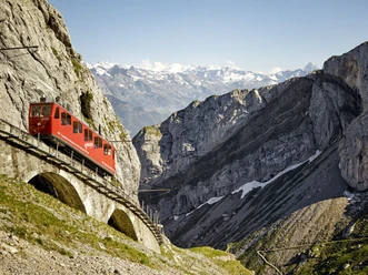
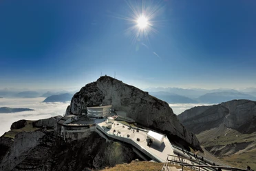
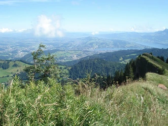
With the steepest cogwheel railway in the world from Alpnachstad or the cable car from Kriens, you reach the Pilatus summit, a 2132-meter-high viewing mountain and spectacular starting point of the Obwalden high route. The view extends far down to Lake Lucerne and over countless Alpine peaks. Alternating between fir forests and alpine meadows, you hike on cozy paths into the wonderful moorland of Langis-Glaubenberg. For refreshment and overnight stays, the Berghotel Langis or the mountain restaurant Schwendi-Kaltbad are recommended.
Day 2
Hearty alpine fare from the alp is a delight and provides strength for the scenic hike over the Glaubenbielen Pass into the panoramic world of Lungern-Schönbüel. Over Chringen to the Dundelegg, you are once again treated to a phenomenal panorama. Then, with the descent to Turren, the last part of the two-day hike is tackled. With the Turren-Bahn you ride comfortably down into the valley to Lungern.
- 13:34 h
- 43.19 km
- 1,611 m
- 2,168 m
- 1,181 m
- 2,070 m
- 889 m
- Start: Pilatus Kulm
- Destination: Turren
Waypoints
Good to know
Pavements
Best to visit
Directions
Directions & Parking facilities
Additional information
In Lungern, there is a connection to the Zentralbahn.
Lungern - Lucerne in 50 min.
Lungern - Interlaken in 60 min.
Author
Obwalden Tourismus
Organization
Obwalden Tourismus
Social Media

Nearby


