Viktor Röthlin Trail - Black

Welcome to my home Obwalden. Thanks to running I have been able to discover many beautiful places around the world, yet I have never lost my roots. I am therefore very happy to now be able to show all running enthusiasts my three favorite trails at Melchsee Frutt.
Black Trail
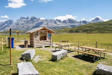
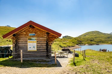
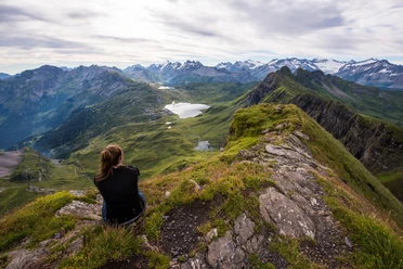
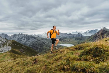
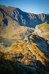
We start from the mountain station with a warm-up going counterclockwise around the Melchsee. From Distelboden we go over a short asphalt section up to the right shore of the Tannensee. Almost at the end of the lake, my trail leads us right onto a beautiful ridge run up to Erzegg and the 2,255m high Balmeregghorn. From Bernerboden it continues to Planplatte and at the beautiful Hääggenstubeli the steep ascent to Hochstollen begins. It’s always worth glancing left at the Bernese Alps with Eiger and Mönch. First the trail runs over alpine pastures, but the higher you get, the narrower the path becomes. Muscles burn, pulse rises, and the surroundings become rockier and rockier. Finally, at the summit cross of Hochstollen at 2,431m above sea level, you forget all the hardships and are rewarded with an incredible 360° panoramic view. My, and surely also your, personal highlight on this round. On the way back to the starting point, the route leads via Abgschütz past the beautiful Blausee to Melchsee Frutt. That evening, you definitely won’t have any trouble falling asleep!
I wish you lots of fun on my trails in the heart of Switzerland. And who knows, maybe we’ll see each other soon. If you pass me on one of my trails, please look back and greet nicely ;-)
Sporty regards
Viktor Röthlin
- 4:00 h
- 23.99 km
- 1,120 m
- 1,120 m
- 1,898 m
- 2,431 m
- 533 m
- Start: Mountain station Melchsee-Frutt
- Destination: Mountain station Melchsee-Frutt
Waypoints
Good to know
Pavements
Best to visit
Tour information
Loop Road
Equipment
Directions & Parking facilities
Drive on the Lucerne – Gotthard highway (A2) and leave the A2 at the “Lopper” junction towards A8, Interlaken – Sarnen. From Sarnen follow the cantonal road towards Kerns, Melchtal, Stöckalp (exit Sarnen North).
Navigation device input: Fruttstrasse 53, 6067 Melchtal
Author
Obwalden Tourismus
Organization
Obwalden Tourismus
Author´s Tip / Recommendation of the author
Nearby
Download GPX file