Viktor Röthlin Trail - Blue

Welcome to my home, Obwalden. Thanks to running, I have been able to discover many beautiful places around the world and yet, I have never lost my roots. So, I am very happy to now be able to show all running enthusiasts my three favorite trails at Melchsee Frutt.
Blue Trail
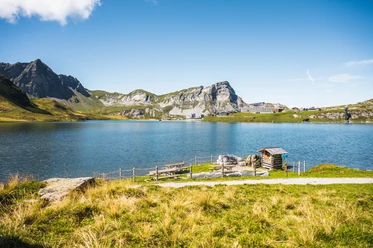
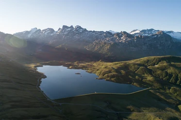
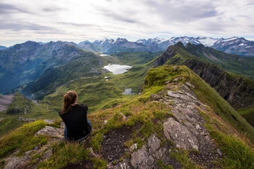
From the mountain station, we start the warm-up counterclockwise around Melchsee. From Distelboden, it goes over a short asphalt section up to the right bank of Tannensee, where you can see the wonderful mountain panorama reflected in the lake during the circuit. My personal highlight is the islands in the back part of Tannensee. Below Bonistock, my trail gently leads us to Melchsee and past the Frutt Lodge back to the starting point.
I wish you a lot of fun on my trails in the heart of Switzerland. And who knows, maybe we will see each other soon. If you overtake me on one of my trails, please look back and greet me nicely ;-)
Best regards
Viktor Röthlin
- 1:30 h
- 9.47 km
- 133 m
- 133 m
- 1,889 m
- 1,987 m
- 98 m
- Start: Mountain station Melchsee-Frutt
- Destination: Mountain station Melchsee-Frutt
Waypoints
Good to know
Best to visit
Tour information
Loop Road
Equipment
Directions & Parking facilities
Drive on the Lucerne – Gotthard motorway (A2) and leave the A2 at the junction "Lopper" towards A8, Interlaken – Sarnen. From Sarnen, follow the cantonal road towards Kerns, Melchtal, Stöckalp (exit Sarnen Nord).
GPS device input: Fruttstrasse 53, 6067 Melchtal
Author
Obwalden Tourismus
Organization
Obwalden Tourismus
Author´s Tip / Recommendation of the author
Nearby
Download GPX file