Zingel on Mueterschwandenberg

From the station, the hiking trail leads across the station square to the Kleine Schliere. Continue along the left dam path to the Städerried nature reserve. From there, the lakeside path leads along Lake Alpnach up to Oberrüti. It is then only a short climb up to Zingel. This was home to a strong fortification during the Second World War.
On Drachenflue, the trail reaches its highest point at 859 m above sea level. In the rock below lies the Drachenloch, where Struthan von Winkelried is said to have defeated a dreaded dragon. Opposite is the Rotzberg with its 12th century castle ruins. The Zingel
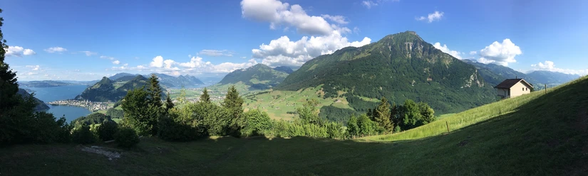
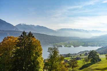
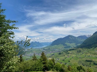
The panoramic view takes in the Pilatus, Rigi and Stanserhorn as well as Lake Lucerne and the Drachenried at the foot of the Mueterschwandenberg.
From Zingel, the trail leads back into the Hinterbergwald forest and then descends southwest to Eichi. Finally, the route leads across the airfield back to the station.
- 3:37 h
- 10.94 km
- 478 m
- 478 m
- 434 m
- 859 m
- 425 m
- Start: Alpnach village station
- Destination: Alpnach village station
Good to know
Pavements
Best to visit
Directions
From Alpnach railroad station, the hiking trail leads across the military airfield to Eichi, where it climbs steeply at first and then long through the Hinterbergwald forest. After the cantonal border with Nidwalden, the signpost shows the short ascent to Zingel.
On the Drachenflue, the trail reaches its highest point at 859 m above sea level. In the rock below lies the Drachenloch, where, according to legend, Struthan von Winkelried defeated a dreaded fire-breathing dragon. Opposite is the Rotzberg with its 12th century castle ruins. The historical legend in the White Book of Sarnen tells of the castle's collapse, which led to the expulsion of foreign rule and the founding of the Swiss Confederation. The Zingel was home to a strong fortification during the Second World War.
The panoramic view offers a clear view of the Alps with the nearby outposts of Pilatus, Rigi and Stanserhorn as well as Lake Lucerne, Stanserboden and Drachenried at the foot of Mueterschwanderberg. In 1941-43, the Drachenried plain, which had been considered as a reservoir as recently as 1919, was drained.
From Zingel, a short section of the trail leads back to Hinterbergwald and then north-eastwards down to Oberrüti. The forest trail leads gently up and down to Lake Alpnach and along the lakeside path through the varied, signposted Städerried nature reserve to the Kleine Schliere and back to Alpnach.
Tour information
Cultural Interesting
Loop Road
Directions & Parking facilities
From Lucerne, change to the A8 in the tunnel towards Interlaken, Sarnen and then take the first Alpnach exit after the Loppertunnel. At Kreissel, take the second exit towards Alpnach and follow the road into the village. In the village center, turn left before the church.
From Interlaken via Brünig on the A8 to the Alpnach exit. At the traffic circle, take the first exit towards the village center and turn right after the church.
Author
Obwalden Tourismus
Organization
Obwalden Tourismus

Nearby

Download GPX file