Four Sources Trail


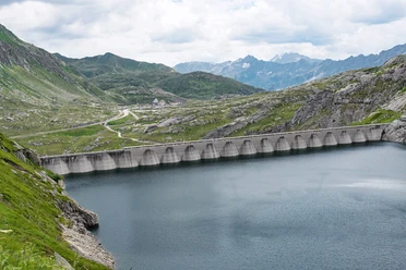
The Four Sources Trail is an alpine hiking trail of about 85 kilometers in length. Over five daily stages, hikers discover besides the sources of four significant rivers also crystal-clear mountain lakes, bubbling streams, and rocky passes into further valleys. You walk through wide plains with mossy areas or green alp pastures with grazing cows. Depending on the season, the variety of flowers around Tomasee or the colorful larch forests in Val Bedretto are impressive. But not only the landscapes change, but also the languages. The first coffee at Oberalppass is ordered in German, a little later you are greeted in Maigelshütte with a Romansh "Bien di". When hiking beyond Lucendropass, you find yourself in the Italian-speaking part of Switzerland: Benvenuti in Ticino. The route ends in the canton of Valais, where hikers face one last ascent to the Belvédère at Furka Pass. The view of the Rhone Glacier is a final highlight.
- 27:50 h
- 85.53 km
- 4,553 m
- 4,326 m
- 1,353 m
- 2,776 m
- 1,423 m
- Start: Andermatt
- Destination: Furka Pass, Belvédère
Good to know
Pavements
Best to visit
Directions
Andermatt - Oberalppass - Tomasee - Vermigelhütte - Piz Giübin - Gotthardpass - Lago Lucendro - Piansecco - Nufenenpass - Obergesteln - Rhone Glacier
Tour information
Cultural Interesting
Nature Highlight
Stop at an Inn
Equipment
- Weather-appropriate clothing
- Good footwear
- Hiking poles are recommended
Directions & Parking facilities
Andermatt is very well accessible from all four directions in summer and is therefore a pleasant starting point.
It is recommended to park in Andermatt or Realp.
The starting point Andermatt is the connection point of the Matterhorn Gotthard Bahn and is therefore very well accessible by train. Also from the end point, the Rhone Glacier, it is reachable by post bus. The timetable is as follows: SBB Timetable
Additional information
Package offer from Eurotrek
Author
Andermatt-Urserntal Tourismus GmbH
Organization
Ferienregion Andermatt
Author´s Tip / Recommendation of the author
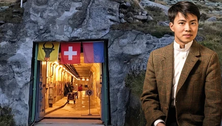
- Sasso San Gottardo
- Gotthard Pass National Museum
Safety guidelines
Observe trail closures and weather forecasts. In the Alps, weather changes can occur quickly.
Nearby


Our recommendations


