High Trail Turren - Brienzer Rothorn


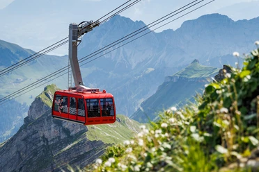
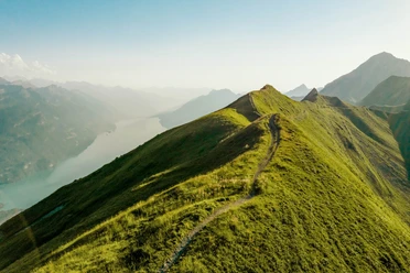
From Lungern, you take the aerial cableway up to Turren. A beautiful mountain path leads you through blooming meadows to Schönbüel. Take a rest here and let yourself be enchanted by the breathtaking beauty of the mountain world. The Wetterhörner are within reach, and the Eiger, Mönch, and Jungfrau are also clearly visible from here. A view into the Central Swiss Alps towards the center of Switzerland or to Titlis is also worthwhile. The hike then continues towards the Brienzer Rothorn. Lake Brienz, the Arniseeli, and the Eisee lie at your feet. In the early morning hours or in slightly cooler weather, chamois and ibex can also be observed up close.
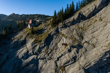
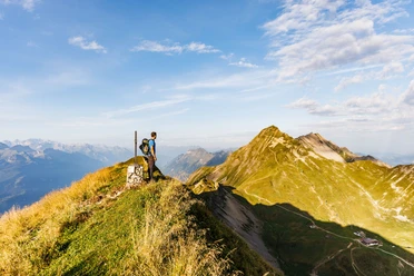
Once you reach the Brienzer Rothorn, enjoy once again the beauty of this region before continuing by aerial cableway to Sörenberg. In Brienz and Sörenberg, you can connect to public transport.
- 3:51 h
- 9.12 km
- 995 m
- 256 m
- 1,513 m
- 2,328 m
- 815 m
- Start: Mountain Station Lungern-Turren-Bahn
- Destination: Mountain Station Brienzer Rothorn Bahn
Waypoints
Good to know
Pavements
Best to visit
Tour information
Mountain Railway Tour
Additional information
Author
Obwalden Tourismus
Organization
Obwalden Tourismus
Author´s Tip / Recommendation of the author
This hike is also wonderful in the opposite direction.
Every Sunday in July and August, you also have the opportunity to start the hike with the sunrise on the Brienzer Rothorn. The aerial cableway from Sörenberg brings you punctually to the natural spectacle on the summit.

Nearby

