Nidwalden High Trail: Stage 1


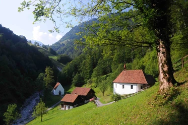
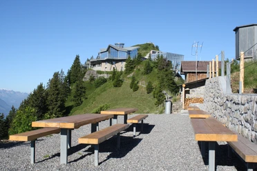
A first highlight even before the hike begins: Ten lakes, countless Alpine peaks, the Vosges, and the Black Forest form the backdrop on the Stanserhorn. Even the journey there is an experience: The world’s first open-top cable car with an open upper deck takes you up Stans’ local mountain. Right next to the mountain station is a revolving restaurant. About halfway around the loop trail around the Stanserhorn, the path descends steeply down the valley via stairs to Holzwang. Here, it’s worth taking a detour to the chapel of the same name.
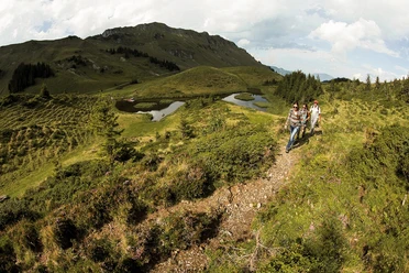
Starting across the meadows of the Ächerli Pass, the wide trail soon turns into a mountain path. Climbing steeply up over root-covered sections, you’ll reach the Arvigrat after about two hours—the ridge that marks the border between Obwalden and Nidwalden.
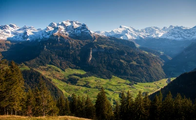
At the highest point, at 2,014 meters, a magnificent mountain panorama unfolds: With views of the Alps—from the Walenstock over the Titlis to the Schreckhorn and the Eiger—the hike along the ridge is a real pleasure. You can even see far into the Vaud Alps and all the way to the Jura. After this first ridge, the rounded Gräfimattnollen lies ahead, followed later by the Gräfimattstand. A zigzag trail leads up to the Schluchberg. The upper, somewhat exposed section of the trail is secured with a rope.
Next comes the crux of this stage: the Wagenleis (Charren) rock notch, a short but exposed section that is also secured with ropes. This section requires sure-footedness and a head for heights. After the Schluchigrat, the descent follows a zigzag trail through a wooded area to the Lachengrätli. From here, you can see into the Engelberg Valley and toward the Walenstöcke. The narrow trail leads around the Storegghorn or Lachenhörnli to the Storegg Pass, the hike’s destination.
Overnight stay at the Oberlachen Alp or the Lauchernalp campground (during the alpine season).
- 5:30 h
- 12.67 km
- 1,150 m
- 1,300 m
- 1,395 m
- 2,088 m
- 693 m
- Start: Stanserhorn
- Destination: Storegg Pass
Waypoints
Good to know
Pavements
- Unknown (1%)Street (2%)Trail (35%)Path (62%)
Best to visit
- suitableDepends on weather
Directions
- Stanserhorn – Ächerli Pass – Arvigrad – Gräfimattnollen – Schluchberg – Storegg Pass
Tour information
Cable car tour
Equipment
- We recommend wearing weather-appropriate clothing and good hiking shoes.
Directions & Parking facilities
- Getting therePublic transportationFrom the Storegg Pass, you can travel via Eggen and from there take two small cable cars to Grafenort, where there are connections to public transportation.
Additional information
- The hike can also be done in the opposite direction, starting at the Storegg Pass and ending at the Stanserhorn mountain station (duration: 5 hours 40 minutes).
For tourist information: Nidwalden Tourism
Author
Nidwalden Tourismus
Organization
Nidwalden Tourismus
Author´s Tip / Recommendation of the author
- The quickest way back to Stans is via the Rugisbalm and Mettlen cable cars. From the valley floor, it’s about a 20-minute hike to the Grafenort cable car station. The hike can also be done in the opposite direction.
Accommodations near the Storegg Pass include the Alp Oberlachen.
Safety guidelines
- The key section is the Wagenleis (Charren) rock notch. This short climbing section is secured with a rope. Snowfields may persist on higher sections well into the summer months.