Schwyzer Höhenweg


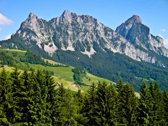
The Schwyzer Höhenweg is characterized by the three historic mountains Rigi, Rossberg, Mythen: each of these mountain masses has its own story to tell. At the Rigi, railway history has especially been written. The history of Rossberg is closely linked to the fateful 2nd of September 1806, when giant rock masses slid from the slopes of Gnipen into the valley, burying 457 people underneath. The story of the Mythen, on the other hand, is a geological one. The Mythen are remnants of a rock cover that has otherwise completely eroded north of the Alps.
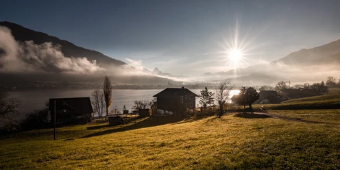
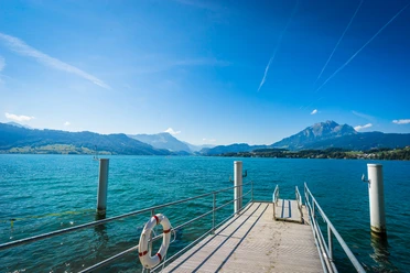
Enough reason, then, to connect the three hiking worlds on the Schwyzer Höhenweg. In the process, you cross both the Rigi and the Rossberg while moving along the striking Mythen. The spectacular panoramic and deep views into the valleys of the original canton as well as onto Lake Zug and Lake Lucerne can be comfortably enjoyed from the Schwyzer Höhenweg, and there is always provision for a refreshing drink along this diverse route.
- 25:50 h
- 65.36 km
- 4,132 m
- 3,707 m
- 432 m
- 1,644 m
- 1,212 m
- Start: Küssnacht
- Destination: Einsiedeln
Good to know
Pavements
Best to visit
Directions
The Schwyzer Höhenweg is divided into the following 5 stages:
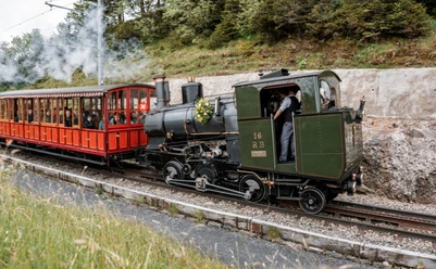
Stage 1, Küssnacht a.R.–Rigi: The Seebodenalp is one of the most beautiful viewing terraces of the Swiss Prealps. It can be enjoyed in peace, as it is not far from there to Rigi Staffel. From Staffel to Kulm, you are in good company with railway guests.
Stage 2, Rigi–Goldau: Down between Rigi Kulm and the ridge leading to Rigi Scheidegg. In view is the Gnipen with the break-off site of the Goldau landslide of 1806. In Goldau, there is enough time to make a detour to the animal park.
Stage 3, Goldau–Sattel: The landslide area is still impressive today, with its debris and boulders as well as the special vegetation reclaiming the space. From Wildspitz, the highest mountain in Canton Zug, you have a beautiful view of the lakes of Central Switzerland.
Stage 4, Sattel–Haggenegg: After a demanding ascent, Hochstuckli is worth a short detour. Panoramic view to the Mythen and into Schwyzland. Then follows a gentle descent to Haggenegg, where the Schwyzer Höhenweg crosses the Way of St. James.
Stage 5, Haggenegg–Einsiedeln: A route under the spell of the Mythen, which is bypassed on the “back side.” From Furggelenstock, the Große Mythen looks deceptively similar to the Matterhorn. Einsiedeln thrives on the dominating monastery church and the well-preserved village core.
Tour information
Cultural Interesting
Familiy-Friendly
Mountain Railway Tour
Nature Highlight
Stop at an Inn
Equipment
Hiking shoes with good tread or trekking shoes, rain jacket, drink, food, possibly poles.
Directions & Parking facilities
Via motorway A4, exit Küssnacht, then via Zuger and Nordstrasse into the center.
Various parking options in Küssnacht (paid). Luterbach parking lot is free.
Take the SBB to Küssnacht. SBB timetable line 29 Meggen-Merlischachen-Küssnacht; line 2 Schwyz-Küssnacht AAGS timetable
Author
Stefan Gwerder
Organization
Schwyzer Wanderwege
Nearby


Our recommendations