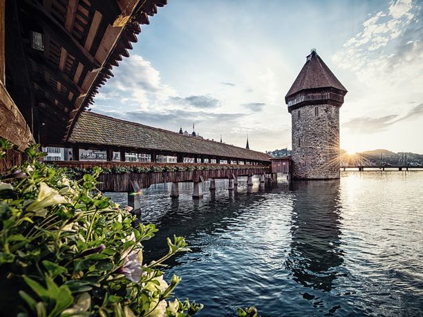
Weg der Schweiz


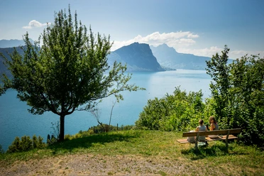
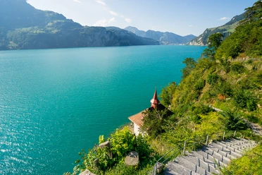
The Weg der Schweiz winds around the deep Lake Uri, sometimes high above, sometimes right on the shore. Sometimes it leads you over stairs carved into the rock, then again follows wide, comfortable paths past many rest and bathing spots. Time and again you enjoy a magnificent view of the lake and the surrounding mountains. Thanks to the boat services, you have a choice of many possible starting and end points.
The initiators succeeded in linking a maximum of home feelings to the path. At the center is the Rütli, an inconspicuous meadow emotionally charged by historical symbolism like probably no other place in Switzerland. The Tell’s Rock with the Tell Chapel is also part of the mandatory visit program.
The attachment of the Swiss people to this path is further strengthened by the idea that the Weg der Schweiz is divided into 26 cantonal sections. Their order corresponds to the cantons' joining the federation. The length of the cantonal sections is based on the cantonal population figures from 1991. At that time, each person symbolically received 5 millimeters.
- 10:30 h
- 34.90 km
- 1,400 m
- 1,400 m
- 434 m
- 873 m
- 439 m
- Start: Seelisberg, Rütli
- Destination: Brunnen
Good to know
Pavements
Best to visit
Directions
Tour information
Cultural Interesting
Mountain Railway Tour
Stop at an Inn
Tour with Dog
Equipment
Hiking shoes with good tread or trekking shoes, rain jacket, drink, provisions, possibly poles.
Directions & Parking facilities
The motorway from Zurich and Lucerne leads via Rotkreuz directly to Brunnen. Parking spaces are signposted in the center of Brunnen.
Muotaplatz – Gersauerstrasse 56 – 6440 Brunnen
P+Rail Brunnen – Bahnhofstrasse 46 – 6440 Brunnen
Boat. Most visitors reach the Rütli by boat. The shortest crossing on the lake is from Brunnen and takes only ten minutes. Boats run regularly. Those wanting a longer boat journey can board at Lucerne. Regular scheduled boats also run from the southern end of Lake Uri at Flüelen to the Rütli. Exact departure times and tour information can be found here: www.lakelucerne.ch
Train and bus. From Zurich and Lucerne, there are hourly and half-hourly services to Brunnen, as well as from Ticino. A bus runs from Brunnen station to the boat dock, but you can also get to the shore of Lake Lucerne on foot comfortably in just 7 minutes. www.sbb.ch
Lake taxi. If you want to travel to or leave the Rütli at a very specific time, there is also a lake taxi in Brunnen. The boat can take 7 people. The 10-minute trip to the Rütli costs about CHF 100. More information at: Speedy Taxiboat. From the Rütli boat station, you can walk either on the gravel path or via the stairs in 7–10 minutes to the Oath Place and the Rütli meadow.
Additional information
The Weg der Schweiz is based on a far-sighted vision: it is to serve as an example of gentle interaction with nature and remain a modest place for encounters. The mountains, the lake, and the magnificent views are still its defining elements today.
Everything about the Weg der Schweiz can be found at www.wegderschweiz.ch
On the Weg der Schweiz, you hike through the homeland of William Tell. Along the way, you encounter witnesses of history and meet hero myths. You can engage with different images of Switzerland and discover your own picture of Switzerland anew.
Everything about the experience region «Cradle of Switzerland» is available at www.wiegederschweiz.ch
Literature
Cultural landscape guide, Around Lake Lucerne. Waldstätterweg & Weg der Schweiz. 2nd edition.
ISBN 978-3-03818-334-1
Author
Jonas Ulrich
Organization
Schwyzer Wanderwege
Author´s Tip / Recommendation of the author
You can combine the hiking sections as you like. From each location, boats, buses, or trains travel to other points along the route, turning your hike into an enjoyable outing.
Map
Hiking map «Weg der Schweiz» 1:25,000 / Federal Office of Topography, Swisstopo.
ISBN 978-3-302-32599-6

Nearby


Our recommendations
