Schwyz Valley and Summit Route
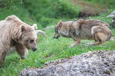
120 kilometers, 6000 meters of elevation and 42 hours of hiking time: the ultimate challenge is what the creators understandably call the King Tour. Pleasure hikers can be spared the ascent on the cable car tour by using the ten cable cars along the route. Those who want it shorter or differently can put the sections together individually. With the panoramic path at the foot of the Mythen and the ridge hike to the viewing platform on the Fronalp summit, the stages are suitable for individualists as well as for families with the Nature and Animal Park Goldau, Sattel-Hochstuckli and the Swiss Holiday Park.
More information at www.talundgipfeltour.ch
Luggage transport
On request, your luggage will be transported for you for only CHF 10 per day from one accommodation to the next, so that you can enjoy your hikes carefree.
Tour pass - discount when using the mountain railways
When you book a tour, you will receive a personal tour pass. This secures you a 20% discount on single rides with the mountain railways. This discount cannot be combined with other discounts (e.g., half-fare card).
Accommodations
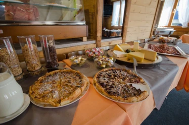
To enable you to design your tour as flexibly as possible, all accommodations offer check-in until at least 9:00 p.m. and breakfast from no later than 7:00 a.m. They also offer the possibility to dry any wet clothes.
- 42:45 h
- 116.72 km
- 6,756 m
- 6,768 m
- 433 m
- 1,904 m
- 1,471 m
- Start: Mostelberg mountain station
- Destination: Mostelberg mountain station
Waypoints
Good to know
Pavements
Best to visit
Directions
From Goldau SBB, use the underpass and follow the signposts. Through the north exit you reach Centralstrasse, which you follow up to the junction with Parkstrasse. On the other side is Rossbergstrasse (signposted). Through a new settlement you come to Bergstrasse, where the mountain path direction markers show you the way. After the area of the cable car construction company Garaventa, the ascent begins. You walk along the edge of the Tennmatt farmstead to the stream and change sides at the small bridge. Shortly after, you reach the Härzigwald. It serves as protection against rockfalls and avalanches for the SBB line Goldau–Zug running at the foot. In great heat, it offers pleasant shade. On the hiking trail built with various switchbacks, the Spitzibüel farmstead is reached. Below the buildings, you come to Flurstrasse, which connects Goldau with the farms in Spitzibüel. There you keep left, and the road leads you in a short time to the next signpost. Now ends the paved road. Hard next to the creek, the natural path ascends and you enter the alp. Keeping left, you reach the ridge, which you follow up to Ochsenboden. Then
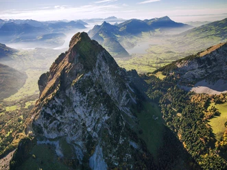
it goes over the Gnipen along the ridge up to Wildspitz.
Section Sattel-Hochstuckli
From Wildspitz, continue down via Halsegg to Sattel. From the valley station of the rotating gondola “Stuckli Rondo” you reach Mostelberg on a well-marked hiking trail.
Section Mythen
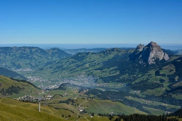
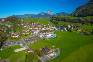
From Mostelberg you circle Engelstock on the panoramic path and ascend via Mostelegg to Haggenegg. (Those staying at Herrenboden should preferably take the direct path to Mostelegg). Along the imposing Mythen, the path continues to Holzegg.
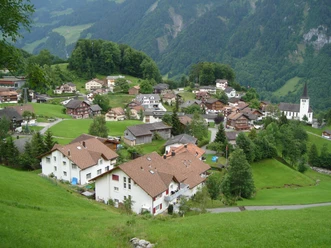
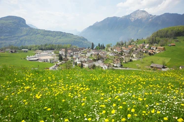
Section Illgau
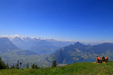
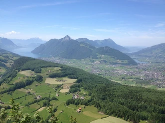
After Holzegg follows Rotenflue, from where you enjoy a wonderful view of the Schwyz valley basin, Lake Lucerne, Lake Lauerz and the pre-Alps. Alongside, you can admire the new Rotenflue cable car, and the associated Gipfelstubli restaurant invites you for a break. On well-developed paths, the tour continues over Müsliegg/Zwäcken up to the Ibergeregg pass. From there it continues to Sternegg via Oberberg to Illgau.
Section Muotathal
In the idyllic mountain village Illgau at 800 m above sea level, a signpost above the village center shows you the path towards Muotathal. The
“old Chiläwäg” was restored a few years ago by retired hiking friends. Behind the gravel deposit, you first climb a slope, then the path leads steeply downhill through a wild romantic forest past a wonderful waterfall. Near the valley bottom in Tristel, close to the Vita Parcours on the bank of the Muota, awaits a spacious built fire pit. Upstream along the Muota, you reach the village of Muotathal at 610 m above sea level in a short time.
Section Wangentritt
At the end of the village is the bus stop 'Hintere Brücke'. From there, the hiking trail follows the impressive Hüribach for a short distance towards Frutt. Via Höch Weidli through the shady forest north around Schwarzstock, you reach Wannentritt at 1596 m above sea level with an imposing view towards the Chaiserstock chain. The path continues over Laubgarten, then on the gravel path to Trölligen, where you can refresh yourself at the alpine farm. From there, you hike leisurely through the beautiful Chruterenwald towards Stoos at 1300 m above sea level.
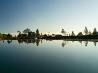
Section Stoos
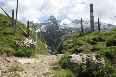
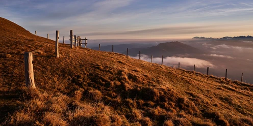
From the small mountain village Stoos at 1300 m above sea level, a 10-minute walk takes you to the valley station of the Klingenstock chairlift. Then, the hiking trail leads via Stoos Hüttä and Holibrig to Metzg, where a few alpine huts are located close together. On the gravel path, it continues past the wooden buildings until a path branches off on the right leading over steep alpine meadows to the Klingenstock summit.
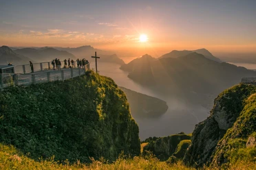
From there, you hike on the well-developed path with constant 360-degree panoramic views via Rot Turm towards Nollen. Behind Huserstock, a short mountain path carved into the rock and well developed and secured thanks to the Gratwanderweg association, leads down to Furggeli. The path requires surefootedness but is wide enough everywhere for two people to pass each other. After the alpine hut in Furggeli, you overcome 200 meters of ascent in a short climb and reach the highest restaurant in the canton of Schwyz on the Fronalpstock summit. From there, the hiking trail leads directly down to the mountain station of the Morschach-Stoos aerial cableway. The viewpoint offers spectacular views of the Schwyz valley basin and a large part of the Schwyz Valley and Summit Route.
Section Morschach
You reach Morschach from Stoos via a beautiful downhill hike on a gravel path and through mixed forests on the northwest flank of Fronalpstock. Almost at the bottom, choose at the signpost a short detour to the country restaurant Nägelisgärtli or continue on the Morschach panoramic path. This leads you via Lourdes Grotto right into the village of Morschach.
Section Brunnen
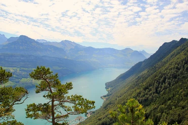
Morschach lies on the Path of Switzerland, which leads from Rütli to the destination Brunnen. In Morschach, you join the Path of Switzerland, which gently ascends to the Axenstein viewpoint. The small terrace offers a lovely view of Lake Lucerne and across to Schillerstein, which stands in the water on the opposite lakeshore. From there, it goes through a pleasant, well-developed forest path towards Brunnen.
Section Rigi-Scheidegg
From Brunnen, the path leads towards Urmiberg. Urmiberg is considered the local mountain of Brunnen. It rises upright at the western end of the village 1140 meters high. First, you hike leisurely along the lake promenade in Brunnen and along the Muota river.
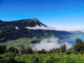
Then the hiking trail gently leads to Wylen and Schrängiggen. From here, you hike steadily uphill via Unter and Ober Brunniberg to the Urmiberg/Timpel restaurant. At the top, you are rewarded with the impressive view towards the Schwyz valley basin, Brunnen and the mountain-enclosed Lake Uri. The cozy terrace of the restaurant invites you to linger.
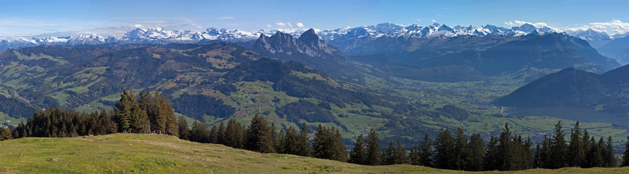
Above the Urmiberg mountain station, the path continues always towards Gätterlipass. After half an hour, you have a choice: either you hike directly to Egg or you take the path to the Gottertli viewpoint and descend from there to Egg. With good visibility, we recommend option 2. Unique views of Lake Zug and Lake Lauerz as well as the small and large Mythen await you. At the Gätterlipass begins the ascent towards Rigi Scheidegg. 60 m below Scheidegg, you reach the mountain inn Burggeist at 1545 m above sea level, and after another 15 minutes, you find yourself at Rigi Scheidegg at the mountain inn.
Section Rigi Kaltbad
From Rigi Scheidegg, you hike comfortably downhill along the Rigi panoramic path to Hinter Dossen. Here the lake path branches off. First, it leads down about 100 meters in elevation to Oberstafel before it joins the Path of Natural Treasures (coming from Hinterbergen). The Path of Natural Treasures is an educational trail on biodiversity with a fantastic wide view all the way to Lucerne and over the Alps. Lake Lucerne lies about 1000 meters below, always at your feet.
The well-developed mountain path again reaches the Rigi panoramic path at Untersetten. Following this, you go around Würzenstock and the view sweeps to Rigi Kulm and over the Mythen. Behind Würzenstock you have a choice: either you follow the impressive rock path to Rigi Kaltbad-First or you stay on the panoramic path. In Rigi Kaltbad, the Mineral Bath & Spa Rigi Kaltbad beckons to relax tired hiking muscles in warm water, as well as various hotels and restaurants.
Section Rigi-Kulm
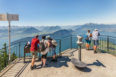
After the romantic rock chapel, the flat path from Rigi Kaltbad leads through cozy forest areas, past interesting rock formations, to the Känzeli viewpoint. There opens a grand panoramic view of the basin of Lake Lucerne, to Lucerne, and the crowning panorama of the Alps. In 1868, Queen Victoria of England visited this place and wrote her enthusiasm in her diary. From here, you always hike uphill to Rigi Staffelhöhe to Hotel Edelweiss. The path continues to Rigi Staffel and another 100 meters higher, you reach Rigi Kulm on well-developed paths. On the highest Rigi summit, you experience a spectacular 360° panoramic view: the view glides over 13 lakes and a sea of peaks. At clear distance, you can spot 24 of the 26 Swiss cantons from Rigi Kulm.
From Rigi Kulm, you hike downhill behind the mountain station past lush meadows to Alp Chäserenholz. At Alp Chäserenholz, the alpine farmer offers his spicy alpine cheese and the cheese dairy with the cheese cellar can be visited. The path leads further to Ober-Schwändi, where you turn right and continue towards Alp Trieb and Riedboden before reaching Rigi Klösterli. At Rigi Klösterli, you have more catering options.
From Rigi Klösterli, you hike above the playful Rigiaa on a well-developed hiking trail downhill. You pass through romantic forest areas with views of impressive Nagelfluh rock formations to Restaurant Dächli, where the legendary Dächli hostess received the very first Rigi visitors in her guesthouse about 400 years ago. From Rigi Dächli, you comfortably continue to Blätzen and follow the path to Arth-Goldau train station.
Tour information
Loop Road
Mountain Railway Tour
Nature Highlight
Equipment
Additional information
Author
Schwyz Tourismus / Schwyzer Wanderwege
Organization
Schwyzer Wanderwege
Nearby


Our recommendations
Download GPX file